|
Bruce
& Betsy Blais |
|
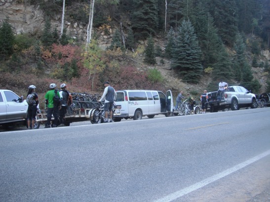
Mountain Biking - Special Trails - BRAIN HEAD, Ut. On October 1st of 2011, while working in Nevada, Bruce joined a group of local riders for a one-day adventure on Brian Head Mt., UT. He spent the day riding the Bunker Creek Trail, and then went onto the Blow Hard Mt. trail. The following sections describe those two rides. The group convoyed up from Vegas and parked, and met the shuttles at the end of the Blow Hard Mt. Trail. There were 28 riders and we filled up both shuttle vans.
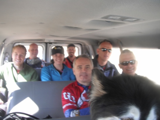
Lots of smiling faces in the first shuttle getting ready for the trip up to the top of Brian Head for the ride down the Bunker Creek Trail.
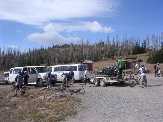
The unloading operation near Brian Head Peak. The altitude at this point was exactly 11,000'.
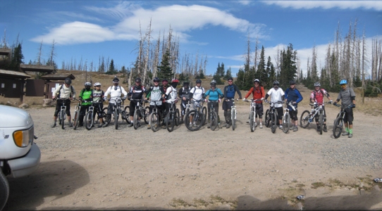
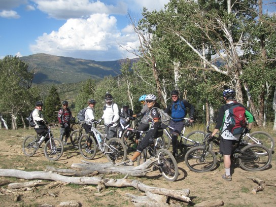
A group photo of most of riders at the beginning of the ride.
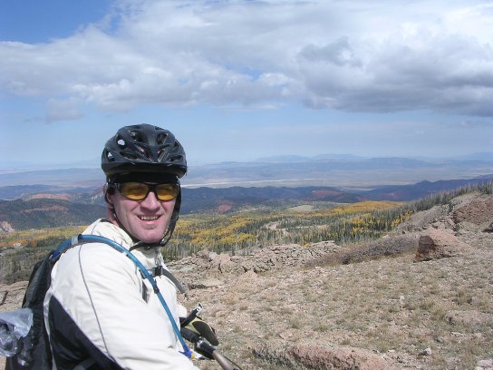
From the parking lot, it is a short ride up to the top. Climbing at 11,000' was more difficult than anticipated. The fall colors were beginning at this altitude. Here is Christian at our first stop.
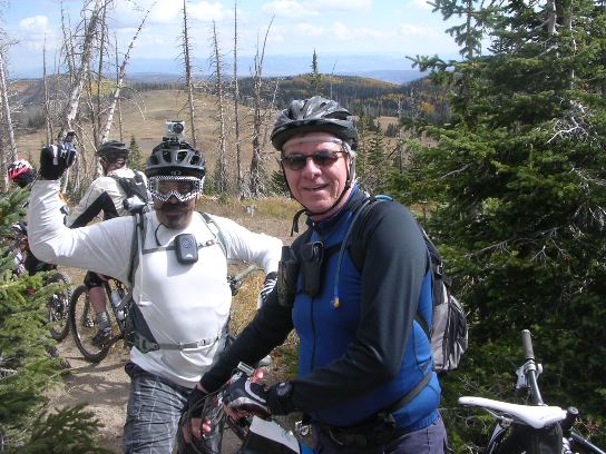
Carlos and Bruce up top near the junction of the Dark Hollow Trail.
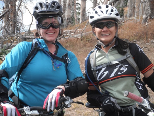
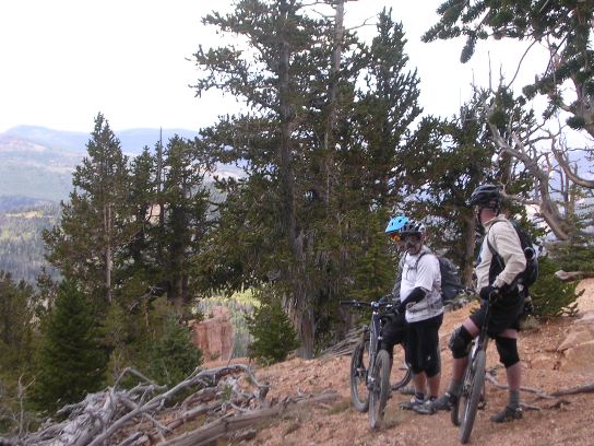
We even had a couple of ladies along for the ride. Here is Chere and Sherry. Bunker Creek is an "intermediate" level trail, and is suitable for anyone with good XC skills.
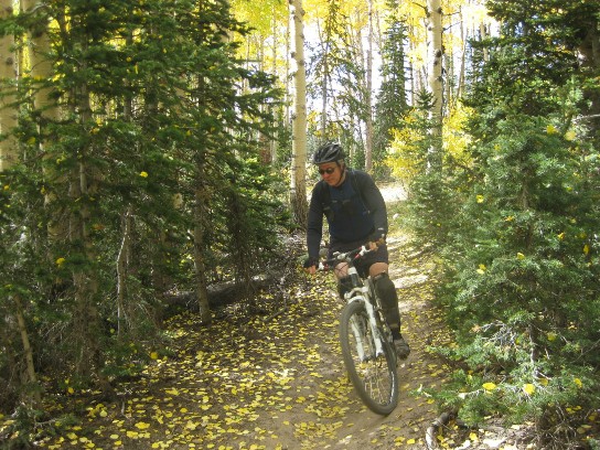
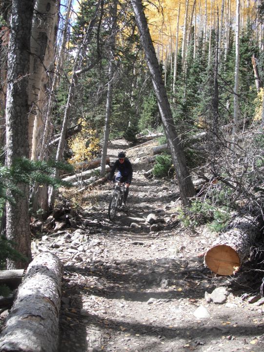
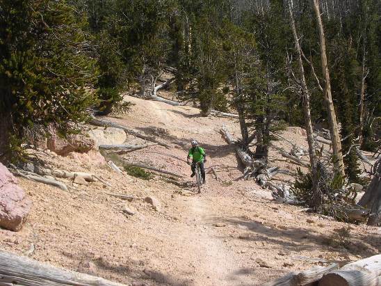
Below is Bruce coming through a group of pines on a smooth section of trail. About one-third of the trail is a smooth ride in the woods.
Not all of the trail was so friendly. Below is a shot of Bruce coming through a rougher section of trail. This is pretty typical of the rougher sections, although were several rougher sections along the way.
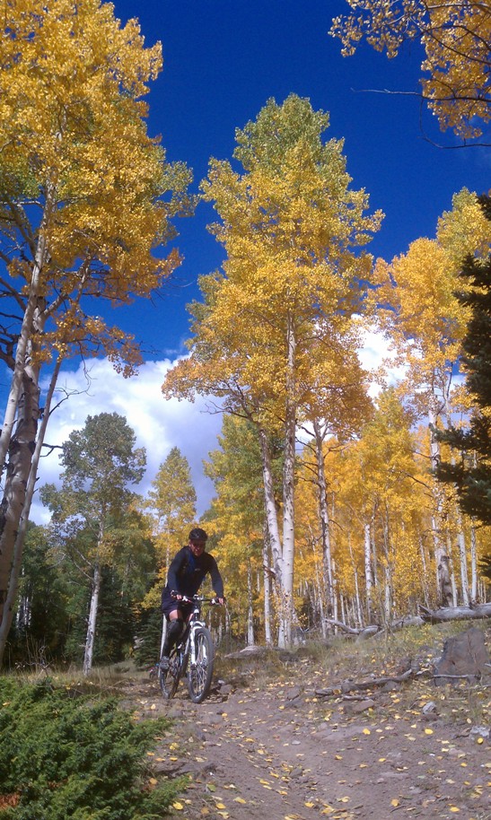
Below is a shot of Bruce coming into a grove of Aspens towards the end of the trail.
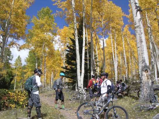
The Aspen Grove made for a nice spot to stop and regroup.
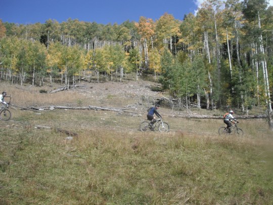
After regrouping, we made the final run through some open meadows to the end of the trail. The Bunker Creek Trail was nearly all down-hill and fast.
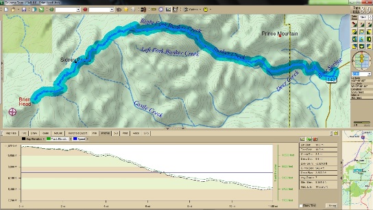
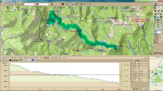
Bunker Creek drops 7' per 100' on average. Total descent was 3,567' in 11.9 miles. Maximum elevation was 11,060'. The elevation at the end of the ride was 8,352'.
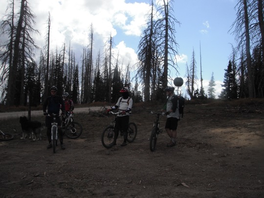
Bunker Creek was a blast, even though it was not too difficult, but we still had Blow Hard Mt. ahead of us, and that was going to raise the bar considerably. The Bunker Creek Trail ended at Panguitch Lake where we met the shuttle. After loading up the bikes and riders, it was on to Blow Hard Mt. to ride that trail. Here we are at the Blow Hard Mt. trail head.
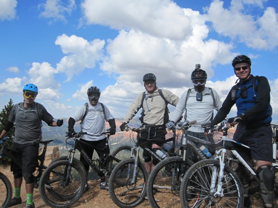
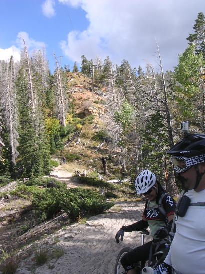
The riders at a regrouping stop on Blow Hard.
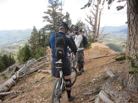
Below is another regrouping stop just before a steep, treacherous descent down the side of the mountain.
Another shot at the regrouping stop with Bruce and Carlos.
Below is a group photo at the regrouping stop.
Below is a shot of the start of the first descent.
Looking back part way down the first descent.
Below is a shot of Ed near the bottom of the first descent. This section of the trail was very loose and hard to maintain control on. Constant braking on loose gravel made for an "interesting" descent.
The shot below shows the first descent from a distance. The run down included several switch-backs. You can see how loose the conditions were from the soil in the photo below.
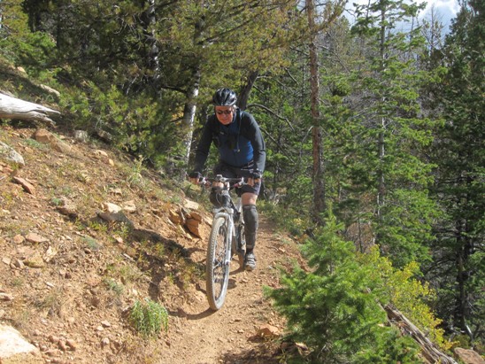
There were a lot of sections that were "bench cut" into steep hillsides. While not too technical, the loose conditions and steep slopes made it necessary to focus on bike control.
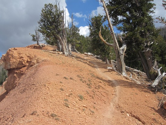
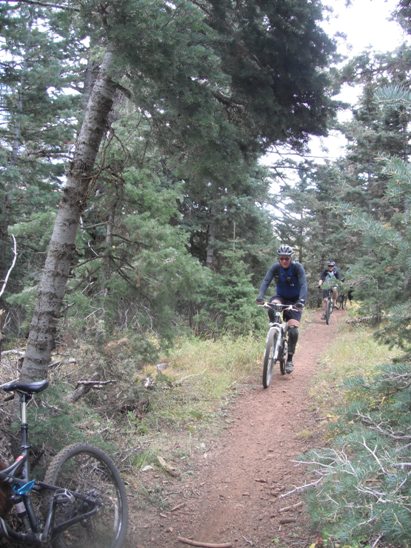
Not all of Blow Hard was a steep down-hill run. The photo below shows a more "sedate" section of the trail.
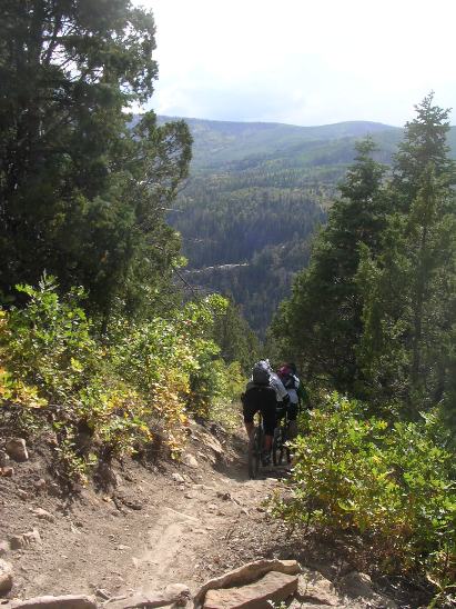
After a section of fairly level riding, it was time for the final descent to the valley floor. Below is a shot of two of the riders on the initial phase of the two-stage descent.
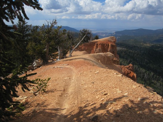
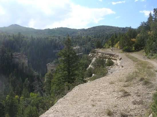
After the initial descent, there is a picturesque ride along a rim above the valley leading to the end of the trail. The trail does a "u-turn" behind the camera position and drops into the valley on the left of the photo. This is another good example of the descents on this trail.
Blow Hard Mt. drops 14' per 100' on average, double that of Bunker Creek. Total descent was 4,080' in 7.1 miles. Maximum elevation was 10,624'. The elevation at the end of the ride was 7,634'.
The trip was well worth it and Bruce is planning on going back in the future to ride the Dark Hollow Trail.
|
|
Version 0.1, October 07, 2011 |