|
Bruce
& Betsy Blais |
|
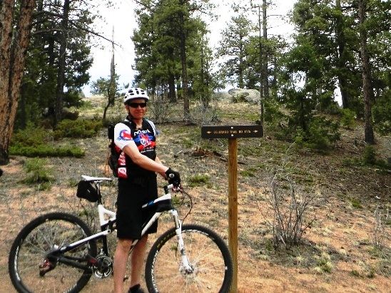
Mountain Biking - Special Trails - BUFFALO CREEK, COLORADO Bruce rode Buffalo Creek four times in 2014: May 3rd, June 21st, July 4th and September 21st. The trail is in the foothills of the Rocky Mountains west of the Denver suburb of Morrison. In May it was with friends from Dallas, Anne Taylor and Jim Able. In June and September it was with the Not-Over-The-Hill-Yet mountain biking group of Denver. On the 4th of July it was with Phillip Bird while helping him train for the Telluride 100 race. Buffalo Creek is an IMBA EPIC Trail ranked #4 in Colorado and #11 world-wide by the International Mountain Biking Association. This trail is a joy to ride because it combines just about every type of trail feature you could ever expect to experience in one ride, and it does so without being overly technical. Intermediate level riders have an opportunity to "clear" just about everything on this trail. It is quite beautiful too. Part of the ride includes the famous Colorado Trail. However, the trail is at 8,000' above sea level, so the altitude will give you as much of a workout as the trail does. The map below shows the track, profile and statistics for the Buffalo Creek Trail ride on September 21, 2014. As you can see from the shaded relief map, this is truly mountain biking. This track and profile is for the clockwise direction which the way it is most commonly ridden. You can right-click on the image below and use the "Save Target As" option to down-load a 1MB 11x17" PDF version of the map. You can also click on the image and zoom up to 200% for a detailed view in a separate window. Right click here to down load the GPX file for this ride. The file may want to save as an XML file, so if it does, change the extension to gpx before you save it. The file is a high-resolution track created on the Delorme PN-60W GPS.
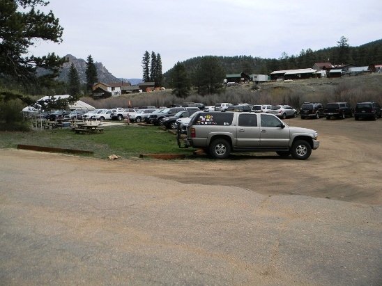
The distance ridden was 24.7 miles and the ride time was about 3 hr. and 30 min. Cumulative climbing was 4,545 feet and was spread out across the entire ride. The average grade was 7% and the maximum elevation was 8,062' AMSL. This is the kind of trail on which you will use all your gears, and spend a bit of time in 1-1. The grades are not impossibly steep, but go on for some distance, making it necessary to slow down to a sustainable climbing pace. The ride ends with 7 miles of sweet down-hill single track. The main trail head is in the community of Buffalo Creek, Colorado on CR-126. This is one of the most popular trail systems in the Denver area, so the parking lot can fill up early.
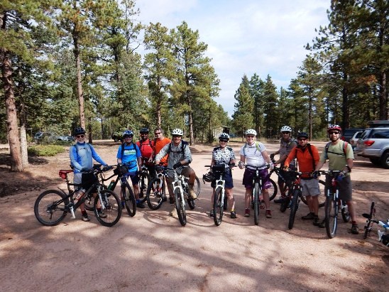
There is another trail head a few miles further out CR-126 named Little Scraggy. It cuts out about 6 miles and 1,000 feet of climbing, but you need to leave a shuttle vehicle at the main trail head to be able to get back to Little Scraggy. Here is the Not-Over-The-Hill-Yet group at Little Scraggy for the September 21, 2014 ride. Diesel (far left), Greg (third in from the left in the back) and Bruce (not pictured) did the 6-mile climb from the main trail head that day.
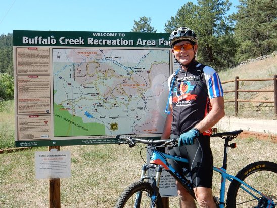
The main trail head has a nice map. Here is a photo of Phillip at the map during the July 4, 2014 ride. The area is expansive and has a lot of trails. Most are marked, but not all are. Bruce has tracks from previous rides and MTBProject GPX files loaded into his GPS for navigation.
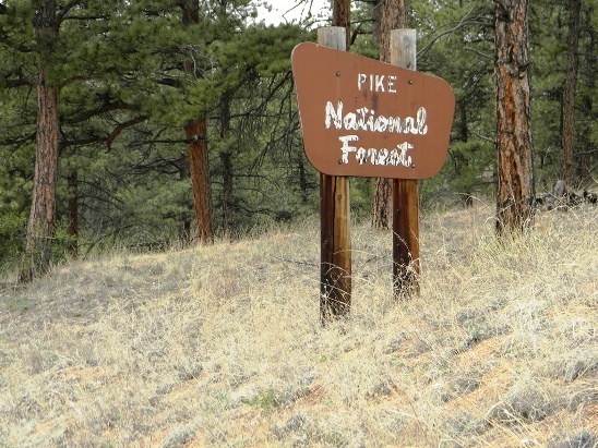
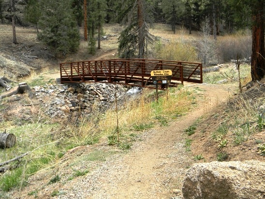
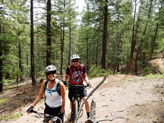
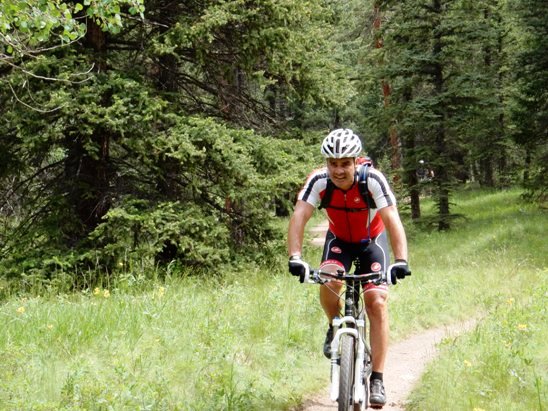
Phillip had registered for the Telluride 100 and needed to train at higher altitudes than were available in Dallas, so Bruce developed a ride plan that had him starting at 8,000 feet and working up to over 10,000 feet. During the 4th of July weekend they rode Buffalo Creek, Alderfer and Centennial Cone. During the three days, they rode 52 miles and climbed over 10,620 feet. On leaving the main trail head and heading to Nice Kitty on a "Jeep road", you are reminded you are in the Pike National Forest.
Further down the "Jeep road", you come to the entrance to the Nice Kitty Trail. The drop to the bridge is one of very few you have for the next 5 miles which is mostly climbing.
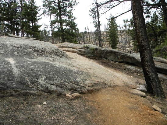
The trail is mostly dirt although there are sections with granite slabs. The photo below shows one first granite slabs you come to.
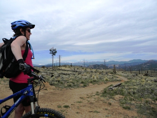
After 5-miles of riding and 1,000 feet of climbing, you reach the top of Nice Kitty. The photo below shows Anne at the top of Nice Kitty at the intersection with the Buffalo Burn Loop on the May 3, 2014 ride. The cleared landscape provides a great view of the mountains.
Below is Diesel and Greg at the top of Nice Kitty during the climb up to meet the main group at Little Scraggy on the September 21, 2014 ride. The clouds and mountains give a good indication of the elevation at this point of the ride.
The Buffalo Burn Trail intersects Section 1776 of the Colorado Trail. The photo below shows Bruce on the Colorado Trail for the first time during the May 3, 2104 ride with Anne and Jim.
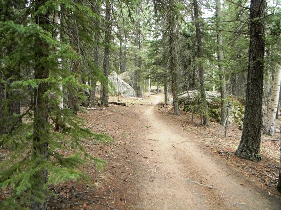
The section of the Colorado Trail you follow for this ride is quite picturesque and easy to ride.
Below is a photo of Bruce on the Colorado Trail during the September 21, 2014 ride. The air temperature was 56F at the time, hence the need to wear the arm-warmers.
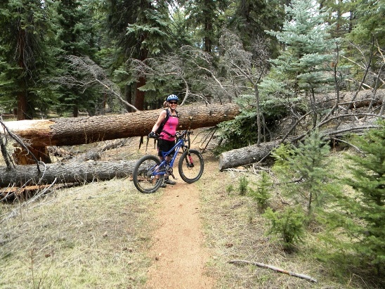
Occasionally, you do encounter obstacles on the trail. Below is Anne at a downed tree during the May 3, 2014 ride.
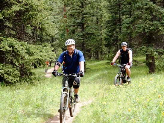
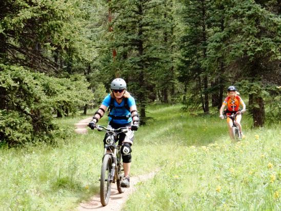
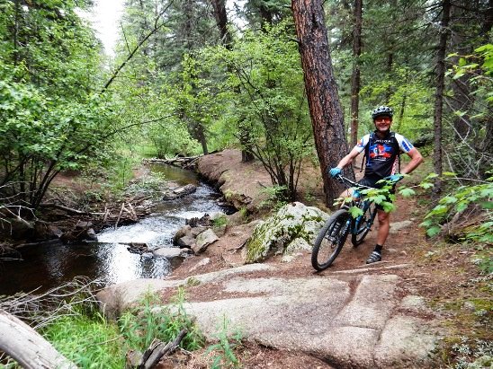
For the most part, the section of the Colorado Trail at Buffalo Creek is an easy ride. Below is a photo of Karen and Bruce during the June 21, 2014 ride with the Not-Over-The-Hill-Yet group.
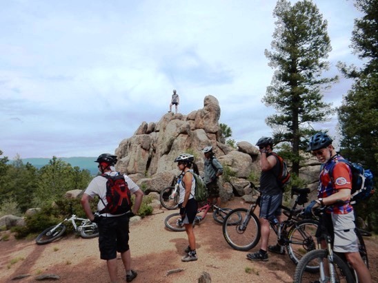
There are interesting rock piles along the way. Here the Not-Over-The-Hill-Yet group stopped for a "photo-op". That is Robert on top of the rock pile.
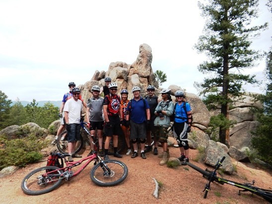
Once Robert came down off the rocks, everyone assembled for a group photo. Karen is behind he camera, so she is not in it. However, she is in the center of the above photo.
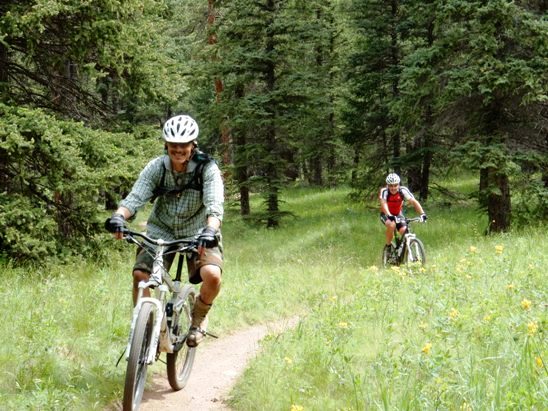
Further down, the trail breaks into a meadow. Below is Ricky enjoying the experience.
Next is Jon coming through the meadow.
Below is Pat, the group organizer followed by Monte.
Next, it is Janet and Sarah.
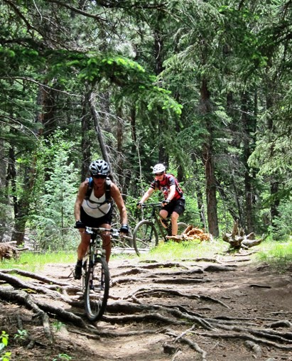
Occasionally you encounter some technical sections. Here is Karen followed by Bruce descending some roots.
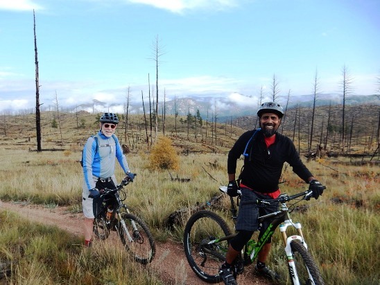
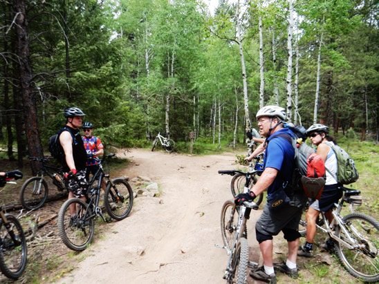
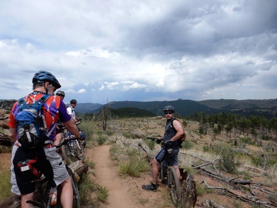
About half-way through the ride, it is decision time. Below, the group is discussing who wants to ride up and over Green Mt. and who want to go around. Bruce and about half the group went left over the mountain during the June 21, 2014 ride. They bypassed it on the September 21, 2014 ride.
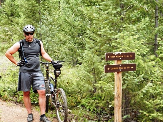
Below is a close-up of the trail marker at the intersection of the Colorado Trail and Green Mt. Loop.
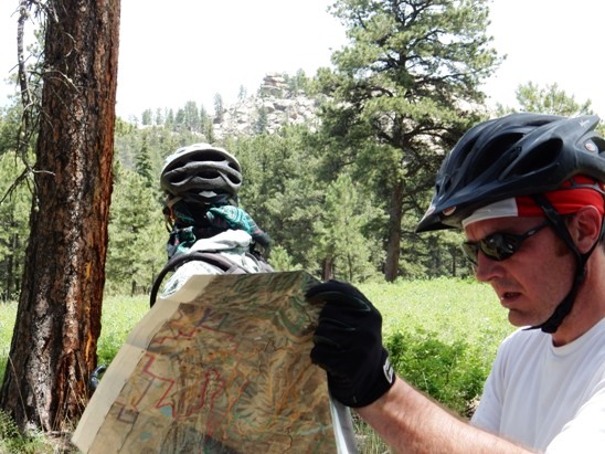
Even with "local knowledge", you can get lost. Here is Aaron checking the map after making a wrong turn coming down off Green Mt. Ricky is checking out a rocky hill.
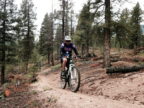
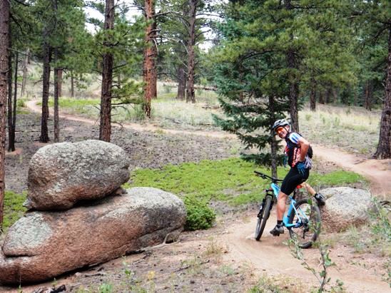
Most of the trail is picturesque, and some parts are exceptional. Below is a photo of Phillip during the July 4, 2014 ride.
Below is another photo of Phillip during the July 4, 2014 ride, next to one of the interesting rock formations along the trail.
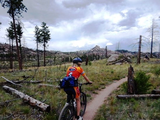
Exiting the Redskin Trail, you pass through another burn area. Below is Sarah on the June 21, 2014 ride. From here is 7 miles of some of the sweetest, down-hill single-track you could ever imagine.
Below is another photo on the single-track during the June 21, 2014 ride.
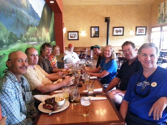
The rides with the Not-Over-The-Hill-Yet group in Denver usually end with lunch at a local restaurant. The photo below is one taken after the June 21st ride when the group gathered at Zoka's in Pine, Colorado for lunch.
|
|
Version 0.1, September 23, 2014 |