|
Bruce
& Betsy Blais |
|
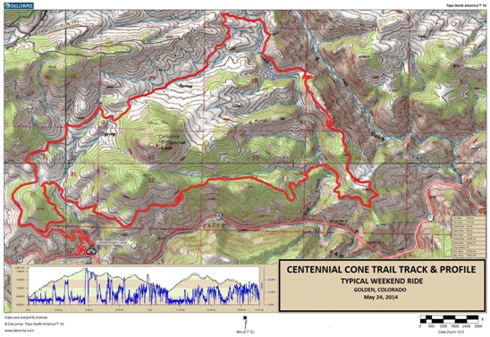
Mountain Biking - Special Trails - CENTENNIAL CONE, COLORADO On May 24th, 2014, Bruce rode what he feels is the "Perfect Trail". Of all the places he had ridden, nothing came close to the pure joy of riding Centennial Cone west of Golden in the foothills of the Colorado Rockies. The trail was long, with a lot of climbing. Most of it was not technical. The vistas were magnificent, and found himself stopping on a regular basis to take photographs. He shared this experience with his friend, Bobby Duncan. Below is a map showing the track, profile and statistics for the Centennial Cone ride. This track and profile is for the clockwise direction. Reverse it for a counter-clockwise ride. You can right-click on the image below and use the "Save Target As" option to down-load a 1MB 11x17" PDF version of the map. You can also click on the image and zoom up to 200% for a detailed view in a separate window. Right click here to down load the GPX file. The file may want to save as an XML file, so change the extension to gpx before you save it. The file is a high-resolution track created on the Delorme PN-60W GPS.
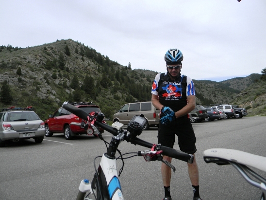
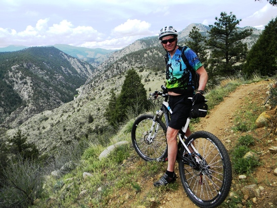
The distance ridden was 16.9 miles and the ride time was 3 hr. and 9min. Climbing was 4,429 feet and was spread out across the entire ride. The average grade was 10% and the maximum elevation was 7,927' AMSL. This is the kind of trail on which you will use all your gears, and spend a lot of time in 1-1. The grades are not impossibly steep, but go on for miles at times, making it necessary to slow down to a sustainable climbing pace. The photo below shows Bobby getting ready. You begin to realize the beauty of this place just standing in the parking lot.
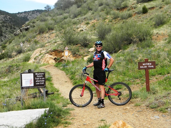
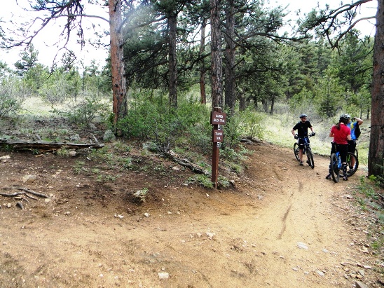
The first trail in the system is Mayhem Gulch. The trailhead is at the west end of the parking lot and is hard to miss. It is important to note that this is an "alternate use" trail on weekends. Mountain bikers have it on even-numbered days and hikers on odd-numbered days. The climb up Mayhem Gulch is 600 feet vertical in 2 miles.
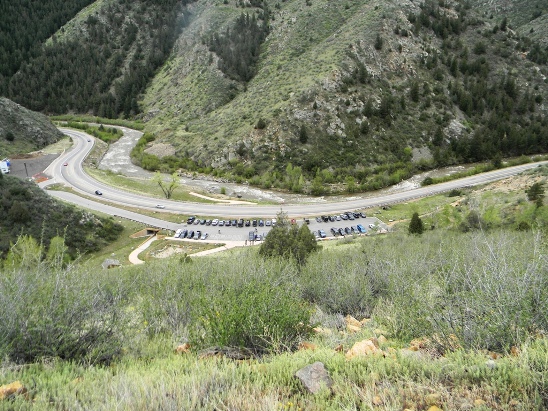
Part way up the trail, you get a bird's eye view of the parking lot and trailhead.
Below is a shot of Bobby "grinding up the gulch". The climb up Mayhem is 2 miles long with grades ranging from 3 to 30. There are a few short down-hill sections, but darn few.
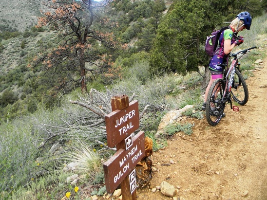
At the top, you reach the intersection with the Juniper trail.
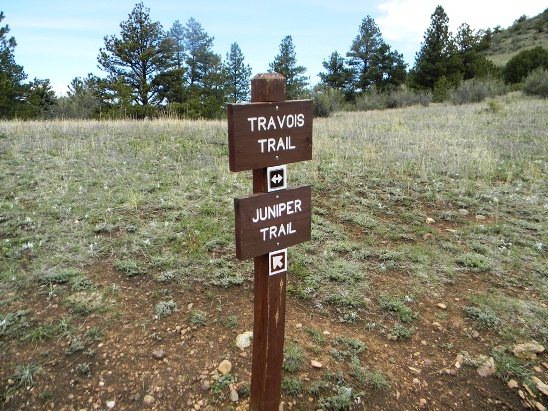
Centennial Cone can be ridden clockwise or counter-clockwise from this point. On this day they went clockwise. The counter-clockwise direction has more climbing at the beginning of the ride. After a mile or so, the Juniper intersects the Travois Trail. At this point you have gone about 2.5 miles and climbed nearly 1,000 feet.
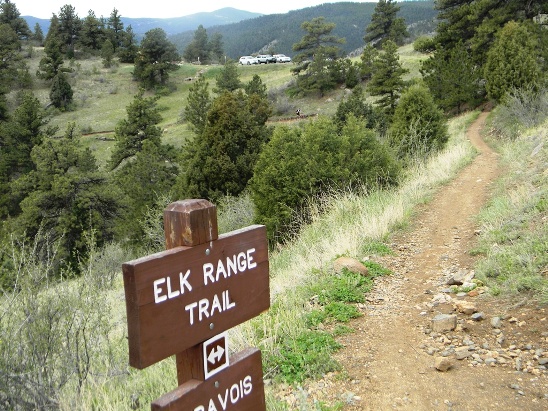
Down the Travois you come to the Elk Range Trail. At this point, the climbing starts to ease up.
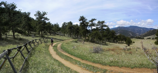
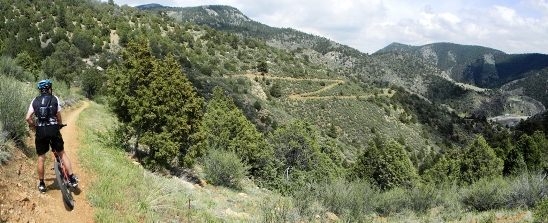
As you travel down the Elk Range Trail, you ride through a beautiful meadow, past a split rail fence. If you look back, you get a gorgeous view to the west.
Once around the bend, it was through a cattle gate and down a fast, smooth section of double-track. The photo below shows Bobby on his way down. Bruce was right behind him and hit his highest speed during the ride here at 29.7 MPH.
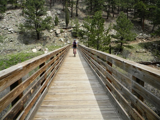
Just past the third parking area and trail head, they crossed their first long bridge.
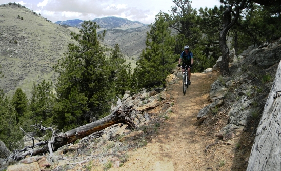
After another "moderate" climb up some more awesome single-track, they came around the bend to even more spectacular scenery.
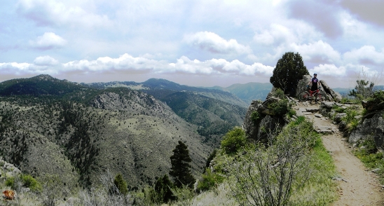
Marvelous vistas behind them, marvelous vistas in front of them!
Around the bend was another fantastic photo op at a pinnacle Bobby dubbed Lovers Leap!
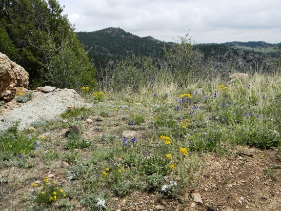
Not all the scenery was in the distance. It was spring time, and the trails were lined with wildflowers.
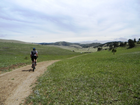
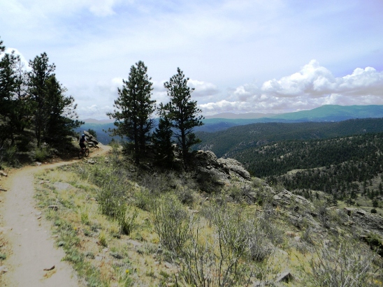
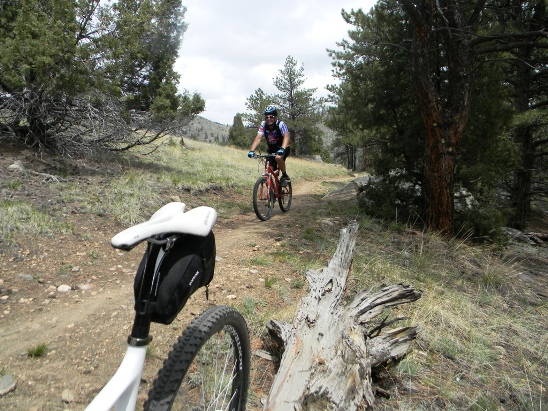
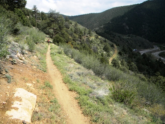
As they rounded every bend, it seems there was another spectacular view. Here is another. Bobby and Bruce never got tired of the scenery.
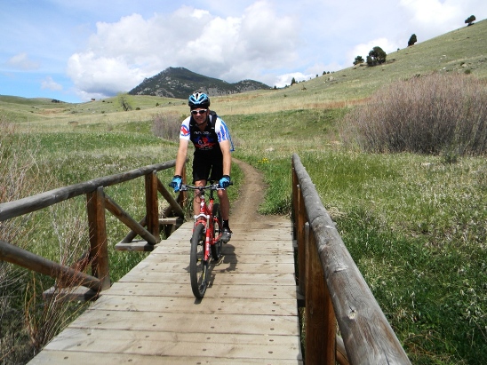
Jefferson County has done a great job on this park. Not only are the trails some of the best around, the bridges are first class too. Here is Bobby coming across one.
The bridges are nice, but it usually means there is more climbing ahead. Here is Bobby topping a 2 mile climb up out of the river valley.
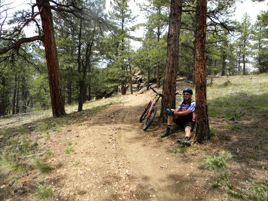
After the climb, it was time for a rest. At this point, they had done nearly 4,000' of climbing, and the legs were starting to wear down.
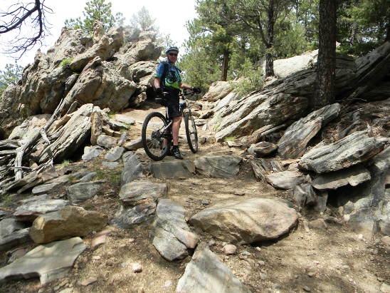
Just beyond the rest stop was a rock pile. Bruce decided to see if his legs had enough in them to make it. They didn't. He made two of the six steps up.
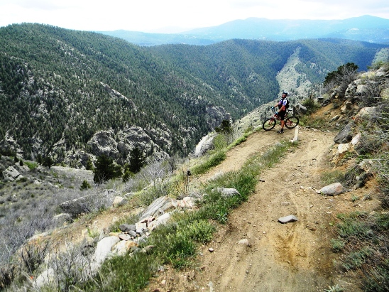
After more climbing, it was time to go down a ways. Here is Bobby stopping for a photo op on one of the descending switch-backs. The trailhead is down by the creek and road seen to the right and below Bobby in the distance.
After a bit more climbing and some down-hills, they were at the Mayhem Trail and ready to make their final descent to the trailhead and parking lot.
About half-way down the Mayhem, they stopped for another photo op showing the end of the descent.
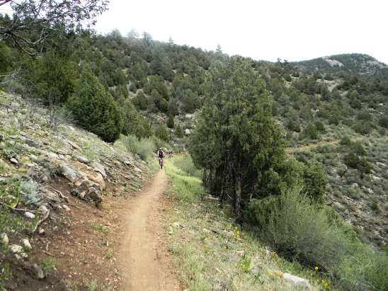
Past the switch-back and toward the bottom of the descent, Bruce took a photo of a local rider on the trail.
It was a fantastic ride. From there, they cleaned up and headed back into Golden for drinks and dinner with friends.
|
|
Version 0.1, May 27, 2014 |