|
Bruce
& Betsy Blais |
|
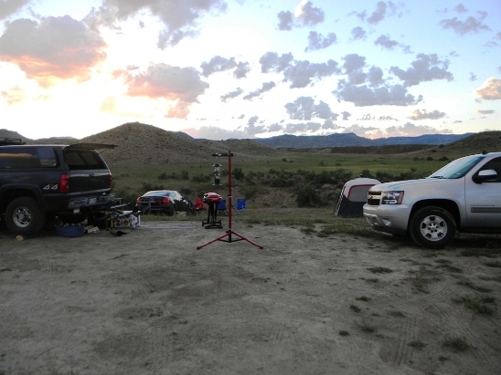
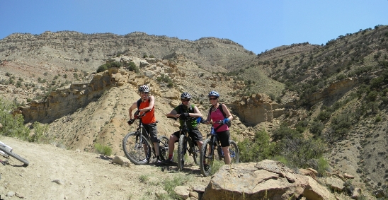
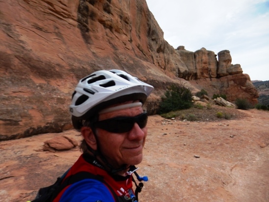
Mountain Biking - Special Trails - 18 ROAD, FRUITA, COLORADO Twice so far in 2014, Bruce had the opportunity to ride the 18 Rd. trails north of Fruita, Colorado. The first trip was the end of May with Jim, Anne and Rob, and the second trip was over Labor Day weekend with Bobby Duncan. Fruita is a sensational place, and one of the top destinations for mountain bikers in North America. The vistas were magnificent, and found himself stopping on a regular basis to take photographs. He shared this experience with his friend, Bobby Duncan. The 18 Rd trails are on BLM land. There are "developed" and primitive campsites. You have to pay $10 per night for the "developed" sites and the primitive sites are free. The only difference with the "developed" campsites is that you get a paved road and a permanent outhouse that is closer to the campsites. Sunrise the morning of May 31, 2014. Since they got in late the night before, the camp was only partially set up. This is how camp looked at sunrise.
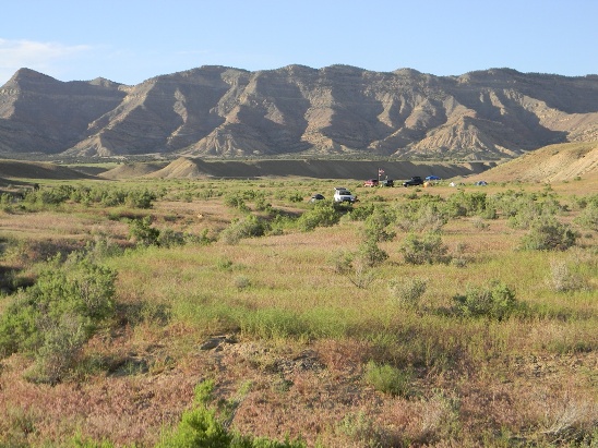
A view from camp looking north to the "hills" later that day. The campsites are spread out, so your neighbors are not too close.
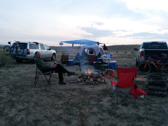
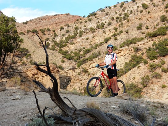
Below is the camp on August 29. 2014 for the four days of Labor Day weekend riding. Bruce is cleaned up and relaxing after doing Prime Cut, Kessel, Edge, Chutes, Down Uppity and PBR. Campfire and grill are started for dinner and a night of relaxation.
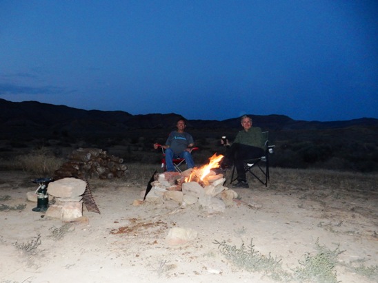
After dinner, it was sitting around the fire, recalling the day's rides and waiting for the sun to finish setting so they could see the spectacular night sky and billions of stars.
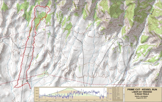
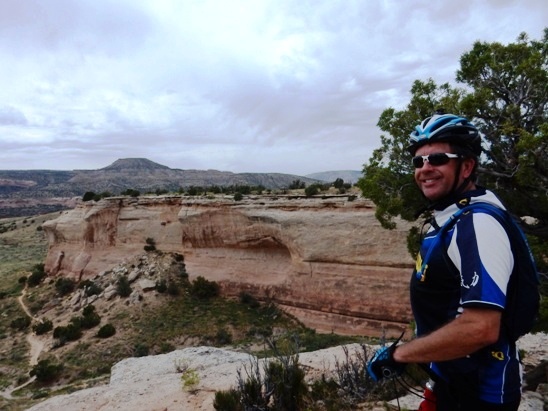
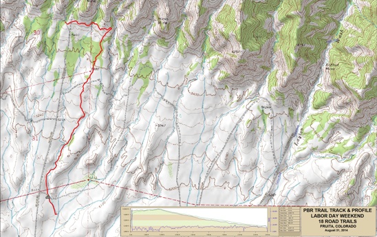
Fruita - Prime Cut & Kessel Run Bruce did the Kessel Run on both the May and August trips. In May, he followed Jim Able up Prime Cut and down Kessel. During the Labor Day trip, he did the same ride, with Bobby Duncan. On that run, he had a GoPro and made a video of Bobby descending the Run. Below is a map showing the track, profile and statistics for the Prime Cut and Kessel ride. Ride was in the counter-clockwise direction. You can right-click on the image below and use the "Save Target As" option to down-load a 1MB 11x17" PDF version of the map. You can also click on the image and zoom up to 200% for a detailed view in a separate window. Right click here to down load the GPX file for this ride. The file may want to save as an XML file, so if it does, change the extension to gpx before you save it. The file is a high-resolution track created on the Delorme PN-60W GPS.
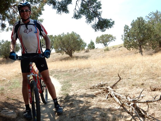
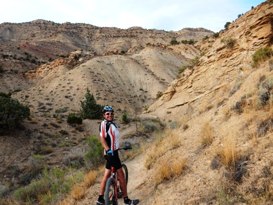
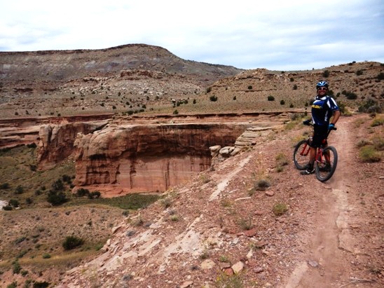
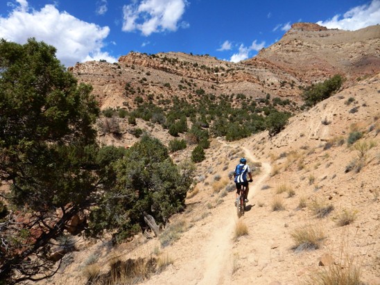
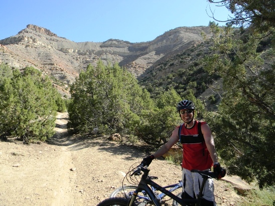
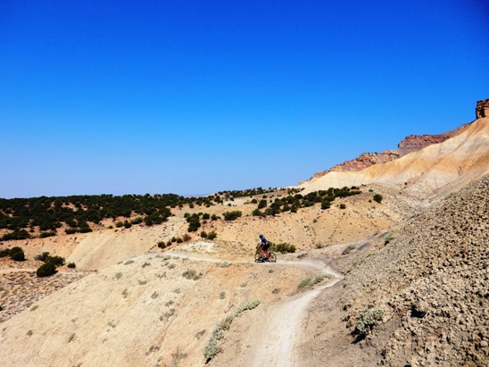
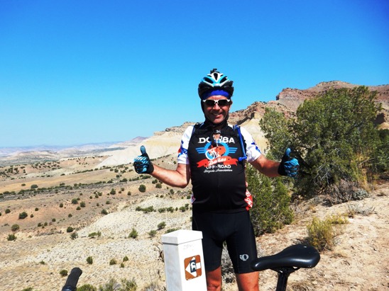
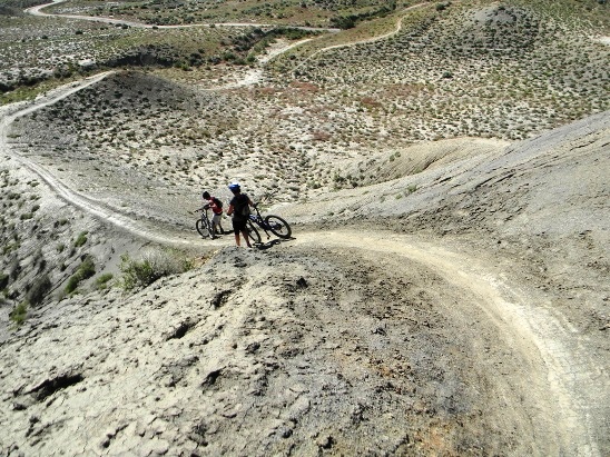
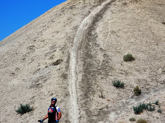
The distance ridden was 5.1 miles and the ride time was just over an hour. Climbing was 587 feet and was primarily during the first half of the ride. The average grade was 4%. This is the kind of trail on which you will use all your gears. The way up is in the lower gears, and the way down is in the higher gears. The grades are not impossibly steep, but go on for some distance. the climbs up are not difficult, and the down-hill on Kessel is over the top. The photo below shows Bobby on Prime Cut on the way up.
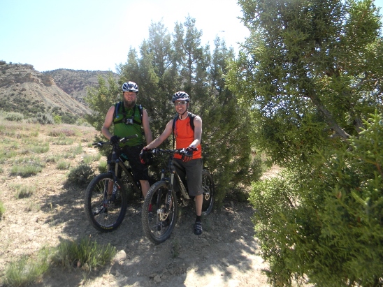
The photo below shows Bobby and Bruce at the top of Prime Cut getting ready to head over to the Kessel Run.
Bruce made a video of ride down the Kessel Run segment of this ride. Use this link to view the Kessel Run video. Fruita - Edge, Down Uppity, Chutes & Ladders & PBR Bruce did this ride on both the May and August trips. In May, he followed Jim, Anne and Rob out the Edge trail to Down Uppity, to Vegetarian, to Chutes and down PBR (Pumps, Berms & Rollers). He did the same ride with Bobby Duncan during the Labor Day trip where he made a video of the run down PBR. Below is Bobby starting out on the Edge Loop.
The photo below is of Jim and Rob during the May trip.
Next we have a panoramic photo of Anne on Chutes & Ladders during the May trip.
Bobby on his way up during the August trip.
Looking back on a climb on Chutes & Ladders during the May trip.
Looking back on the climb, but this time with Bobby in the photo.
Below is a photo of Bruce near the top of Chutes & Ladders during the May trip.
Rob, Jim and Anne near the top of Chutes & Ladders during the May trip.
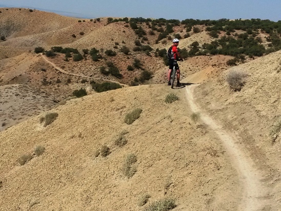
Bobby near the top during the August trip.
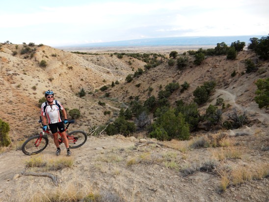
Below is a panoramic view looking towards the south and PBR from up near the west end of Chutes & Ladders during the May trip.
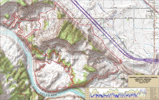
The way back was via PBR, but since this is a fast down-hill run, and Bruce didn't have the GoPro for this ride, that is all you will see. They did PBR two days later, and this time there was video. On August 30, Bruce and Bobby rode the Kokopelli Trail System southwest of Fruita. The ride consisted of Mary's, Horse Thief, Steve's and back via a gravel road. Nearly half of the route followed the Colorado River. Below is a map showing the track, profile and statistics for the Kokopelli ride. Ride was in the clockwise direction. You can right-click on the image below and use the "Save Target As" option to down-load a 1MB 11x17" PDF version of the map. You can also click on the image and zoom up to 200% for a detailed view in a separate window. Right click here to down load the GPX file for this ride. The file may want to save as an XML file, so if it does, change the extension to gpx before you save it. The file is a high-resolution track created on the Delorme PN-60W GPS.
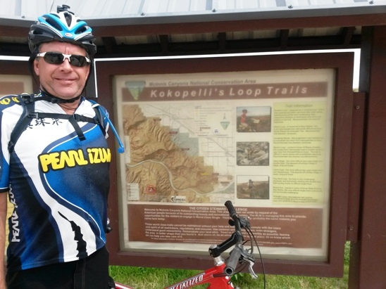
Below is a photo of Bobby at the Kokopelli trail head.
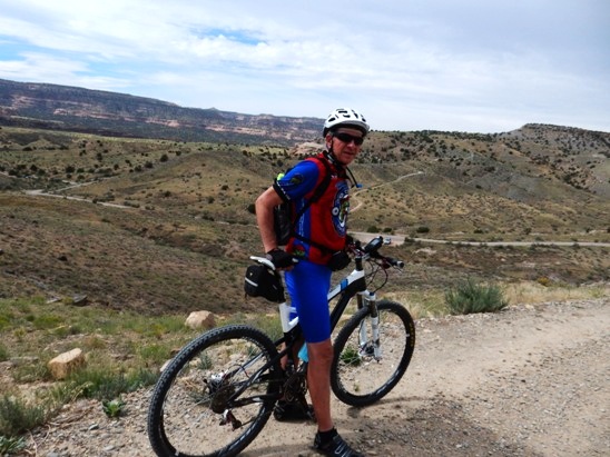
After a short climb up a gravel road, the trail system and Colorado River came into view.
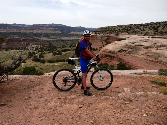
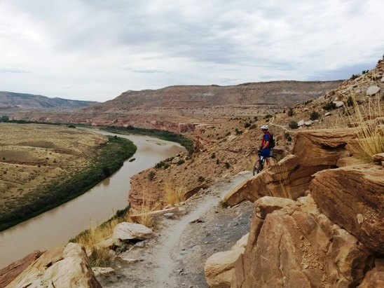
They started out on Mary's which followed the bluffs along the north side of the Colorado River. Below is a photo of Bruce on the bluffs on the way out.
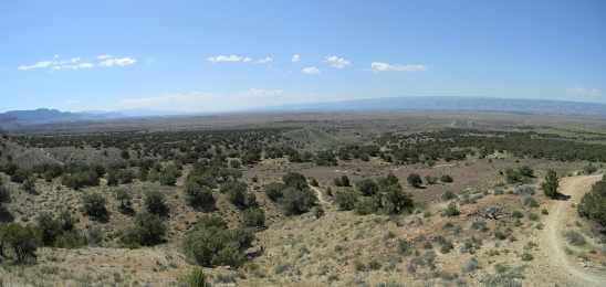
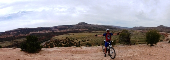
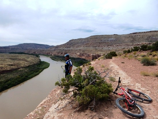
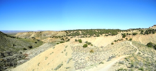
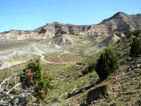
The vistas were magnificent! Below is a panorama of Bruce further down the trail
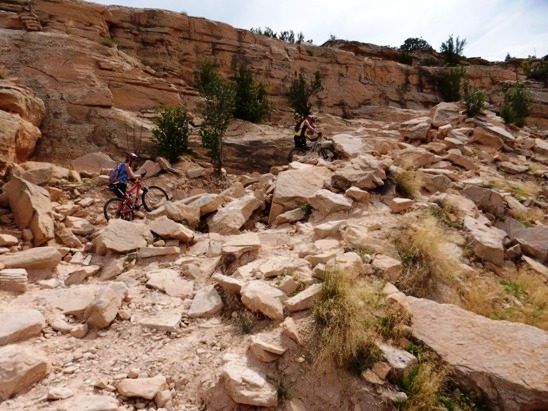
About half-way out Mary's, the Horse Thief Bench Loop branches off. The way down is what Bruce considers to be a triple black diamond descent. Most riders walked it, although a few rode about half-way down and then walked.
Once down, you see the bluffs from an entirely different perspective.
Along the way, there were some interesting rock formations carved out by the river in the past.
After completing Horse Thief, it was time to hike the bike back to the top of the bluff.
Back up top, the vistas continued. To say the trail provided sensory overload would be an understatement.
As you can see from the photo below, the trail continued along the bluffs and the Colorado River for quite a distance.
Below is Bobby in a state of total fascination with the experience.
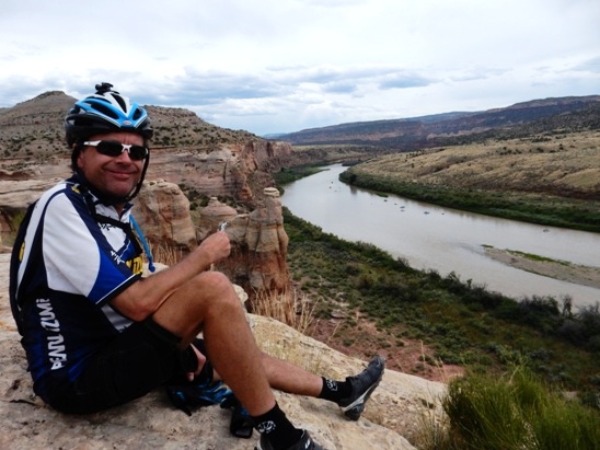
Part way out, it was time for a little nourishment. They picked a nice spot and refueled. The objects in the river are the rafts of a large group of folks drifting down the Colorado.
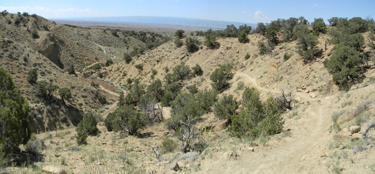
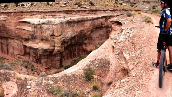
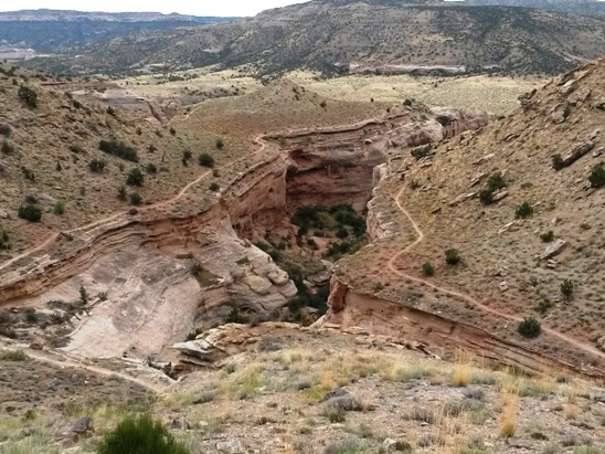
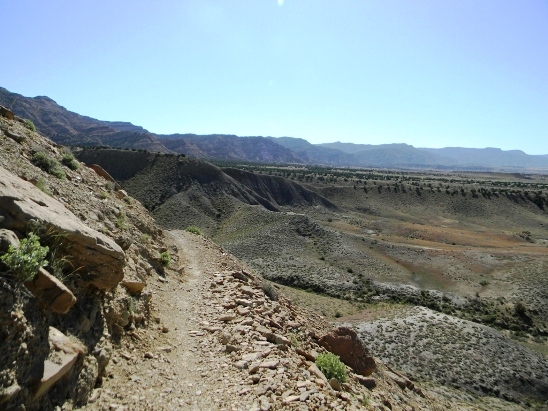
Next, it was out on Steve's Loop. This was the most spectacular part of the entire ride. The trail continued to follow the bluffs, and got to within a few feet of the edge in places.
The sensory overload extended around every bend. At this point, the trail went in and out with the washes.
Below is a photo on one of the many washes as seen from on high. Notice how trail follows the edge.
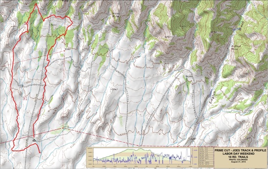
Fruita - Prime Cut & Joe's Ridge Joe's Ridge was an interesting ride in that it combined some of the ridge riding of Zippity with the pumps, berms and rollers of PBR. Joe's parallels both Kessel and Zippity, lying between the two. Below is a map showing the track, profile and statistics for the Prime Cut and Joe's Ridge ride. Ride was in the counter-clockwise direction. You can right-click on the image below and use the "Save Target As" option to down-load a 1MB 11x17" PDF version of the map. You can also click on the image and zoom up to 200% for a detailed view in a separate window. Right click here to down load the GPX file for this ride. The file may want to save as an XML file, so if it does, change the extension to gpx before you save it. The file is a high-resolution track created on the Delorme PN-60W GPS.
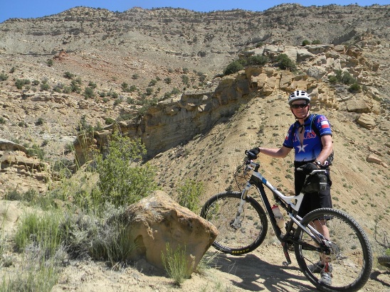
The distance ridden was 5.1 miles and the ride time was just over an hour. Climbing was 587 feet and was primarily during the first half of the ride. The average grade was 4%. This is the kind of trail on which you will use all your gears. The way up is in the lower gears, and the way down is in the higher gears. The grades are not impossibly steep, but go on for some distance. the climbs up are not difficult, and the down-hill on Kessel is over the top. The ride started by climbing Prime Cut (again). Below is a photo of Bobby on his way up.
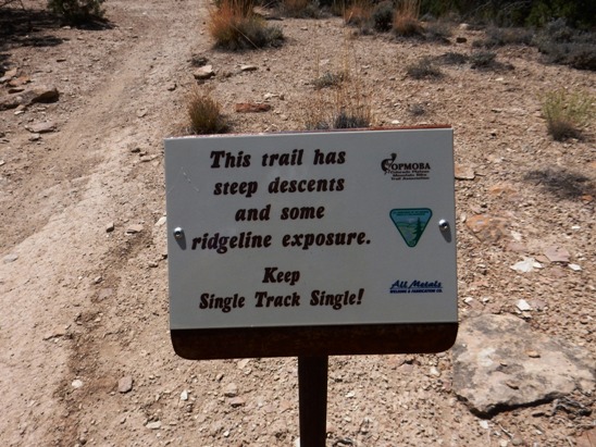
Soon after turning onto Joe's, you encounter a "warning sign". Anyone that knows Fruita knows to expect this kind of stuff on Joe's and Zippity.
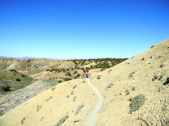
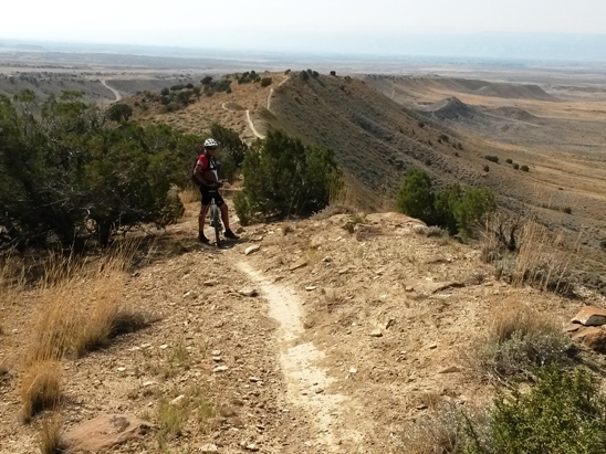
Next, you start out on the ridge. Below is a shot of Bobby getting started.
At this point, the still camera was put away and the GoPro was switched on. Use this link to view the Joe's Ridge video. Fruita - Pumps, Berms & Rollers (PBR) Shuttle Ride BPR is a down-hill blast. Needless to say, once you start down, there is no stopping to take photographs. To see what it is like, watch the video using the link at the end of the trail description. Below is a map showing the track, profile and statistics for the PBR shuttle ride. You can right-click on the image below and use the "Save Target As" option to down-load a 1MB 11x17" PDF version of the map. You can also click on the image and zoom up to 200% for a detailed view in a separate window. Right click here to down load the GPX file for this ride. The file may want to save as an XML file, so if it does, change the extension to gpx before you save it. The file is a high-resolution track created on the Delorme PN-60W GPS.
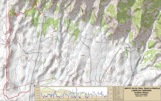
The distance ridden was 2.6 miles and the ride time was about a half an hour. A half mile was on the Edge Loop trail from the parking lot to start of PBR. The trail dropped about 600' in 2.1 miles. The average grade was 5%. While Kessel is mostly a swooping, flowing down-hill run, PBR has a lot of pumps and rollers, and is decidedly more three-dimensional than Kessel. Use this link to view the PBR video. Like many of the other trails, Zippity Do Da was ridden during both the May and August visits. Both times it was done as a shuttle ride since it is the finale and usually the last ride of the visit. Below is a map showing the track, profile and statistics for the Zippity ride. You can right-click on the image below and use the "Save Target As" option to down-load a 1MB 11x17" PDF version of the map. You can also click on the image and zoom up to 200% for a detailed view in a separate window. Right click here to down load the GPX file for this ride. The file may want to save as an XML file, so if it does, change the extension to gpx before you save it. The file is a high-resolution track created on the Delorme PN-60W GPS.
The distance ridden was 4.3 miles and the ride time was about an hour. A mile was on Front Range trail from the parking lot to start of Zippity. The trail dropped about 600' in 3.3 miles with an overall descent of 996 feet. The average grade was 7%. You can either shuttle up to the parking lot or ride the Edge Loop up from the camping area. Either way, you take Front Range out to the start of Zippity.
Below is a photo of Rob on Front Range during the May 2014 trip.
Another photo of Rob further out on Front Range.
Below is a photo of Bruce at the same spot on the August 2014 ride.
Next is Bobby heading out Front Range towards the Zippity Trail Head.
The following photo from the May 2014 ride gives a wider view of the approach to Zippity.
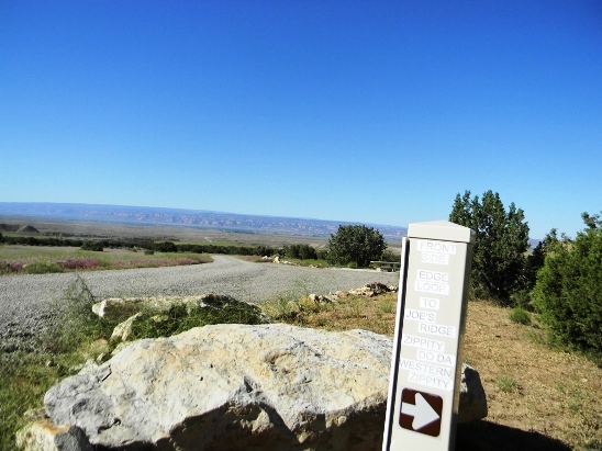
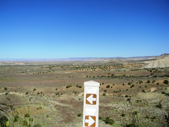
The trail marker says you have arrived!
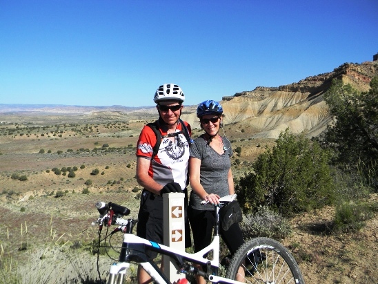
Below is a photo of Bruce and Anne at the start of Zippity during the May 2014 ride.
Below is Bobby at the Zippity Trail Head during the August 2014 ride.
The next photo from the August 2014 ride shows Bruce just past the trail marker and gives a nice view of the first ridge.
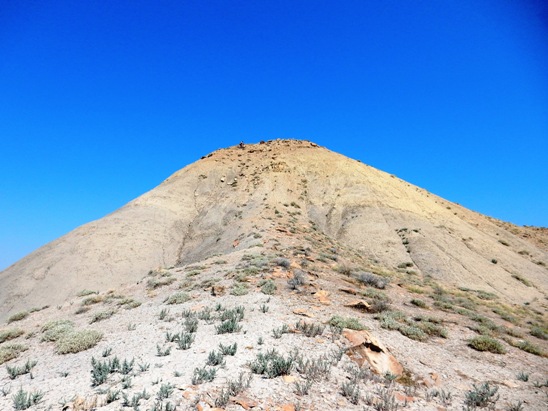
At the end of the first ridge, there is a bench-cut in the top of the hill. The photo below shows just how high up you are at this point.
As if the photo above wasn't enough, the one below shows Bobby on the bench-cut during the August 2014 ride. Bobby is the large black speck just to the left of the peak.
The photo below gives a long view of the bench-cut and and descending trails.
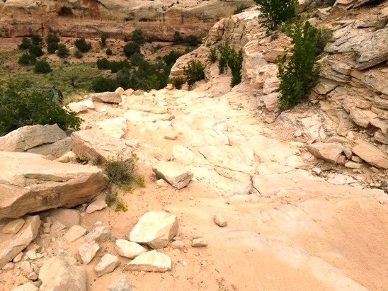
Further down, Bruce, Anne and Rob came to a steep drop in May. It was loose, so not having ridden it before, they elected to walk down. Even walking was a chore. In August, Bruce rode down it, and this is in the video for this trail.
The photo shows Bobby happy to have made it down one of the several steep drops on Zippity.
And finally, a photo looking back on the first section of Zippity.
A video was made of most of the run down Zippity. The climbing sections have been edited out since they are not nearly as exciting as the other sections. Use this link to view the video.
|
|
Version 0.2, September 12, 2014 |