|
Bruce
& Betsy Blais |
|
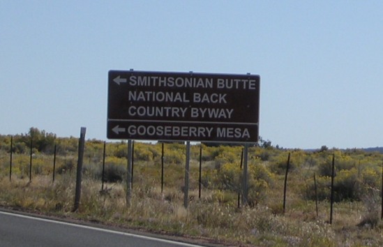
Mountain Biking - Special Trails - GOOSEBERRY MESA, Ut. On April 16th and 17th of 2011, Bruce was working in Nevada and hooked up with the Las Vegas Mountain Biking Group for a two-day adventure on Gooseberry Mesa just outside Hurricane, UT. He spent two days on the mesa, and says it was the greatest two days of biking up to this point in his life. He followed up with another day trip on October 15th. Gooseberry is 14 miles east of Hurricane, UT on SR-9. When leaving Hurricane, travel 12 miles to the Apple Valley general store and go 2 more miles to the cutoff, which is well marked.
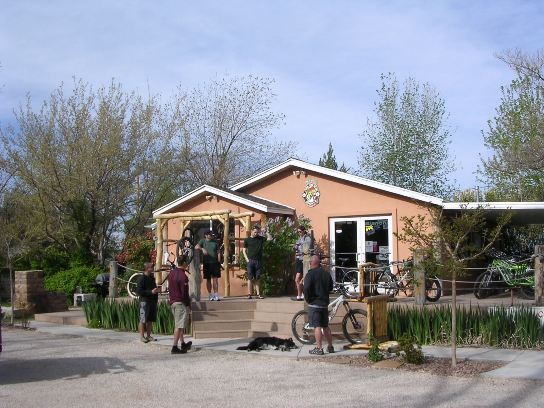
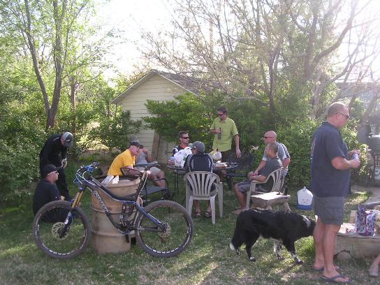
Travel 3-4 miles out the dirt road off SR-9 and turn left on the dirt road marked by the Gooseberry Mesa sign. Total driving time from Las Vegas to the parking lot on the Mesa is about 2 ½ hours. He drove up from Vegas on Day 1 with some other folks. The photo below shows the early arrivers from The LVMBG at Over The Edge Sports in Hurricane. Ultimately, 24 riders would participate in the ride, breaking up into three groups.
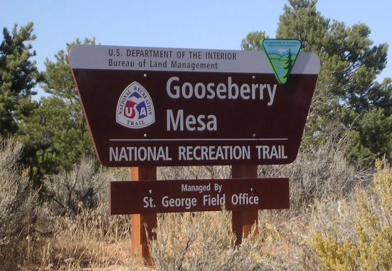
From the shop, it was down the highway and up the dirt road and onto the mesa. The first thing you come to is the main sign.
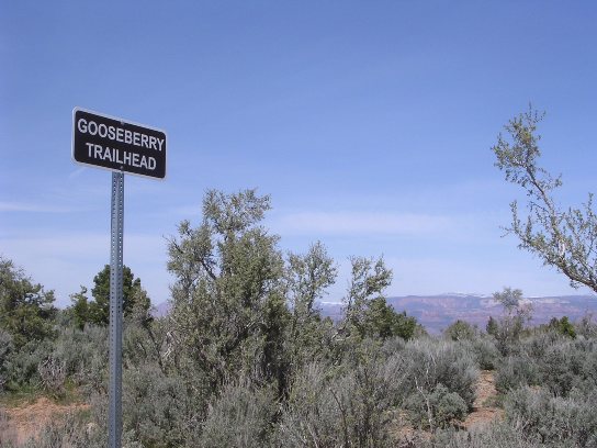
Bear to the left and proceed to the White trailhead.
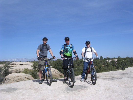
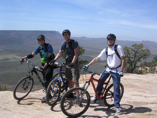
The photo below shows Jeff, Bruce and Jason at the slick rock practice section. The practice section was very useful in preparing them to ride the "real" stuff. He highly recommends it for first-timers. It gives you a good feel for handling the terrain without being too challanging.
Below is part of the group at "Wedding Rocks". It is called Wedding Rocks because a local couple got married at this location. I guess if your wedding starts out on the rocks, it can't get any worse. The rider on the left is Ed, our leader. Jason is in the middle and Debbie is on the right.
The following photo shows one of many climbs along the trail out to trail head for the South Rim. This was one of the easiest.
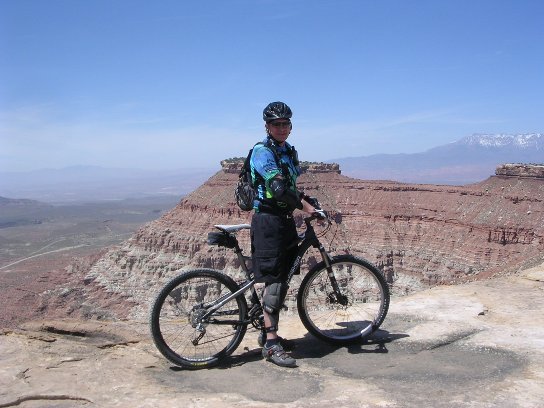
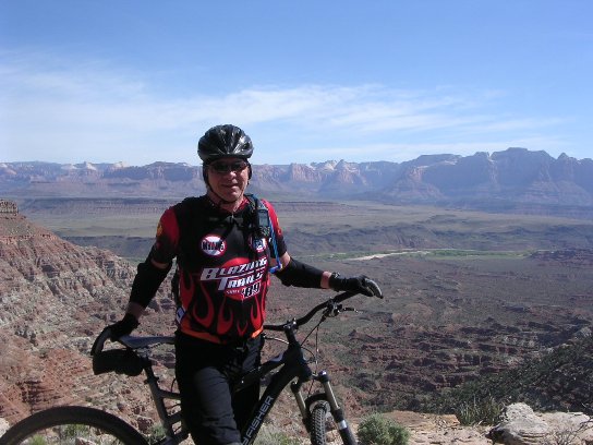
Next is Bruce at the beginning of the South Rim Trail. From here, the trail follows the edge of the Mesa to the "Point". The GPS track on the topographic map further down shows how the trail hugs the edge of the mesa.
Bruce, Jeff and Jason below at the beginning of the South Rim Trail. The South Rim Trail is about 1,200' above the valley floor.
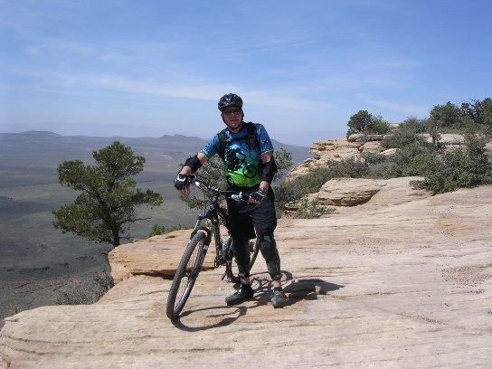
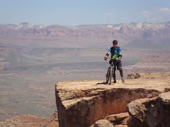
Below is a photo of Bruce nearly out the the "Point". The point is the rock ledge on the right-hand side of the photo. That is as far as you can ride, or even walk for that matter.
The photo below is Bruce on the north side of the "Point". Zion National Park is in the mountains in the background.
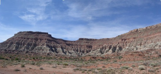
A ground-level view of the "Point" is shown below. The "Point" it the high spot near the center of the photo. The trail follows the edge of the mesa from the right-hand side of the photo to the "Point". This ride offers some spectacular views as well as some "white-knuckled" trail sections within a few feet of the edge of the mesa.
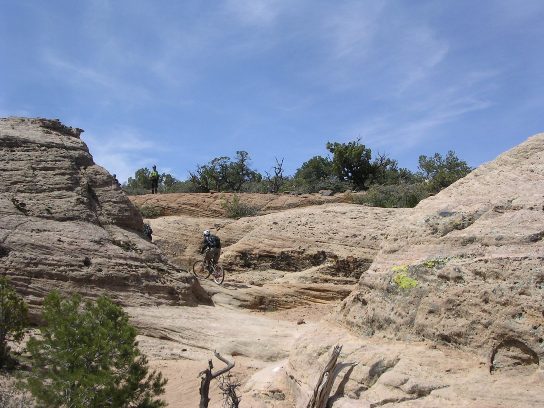
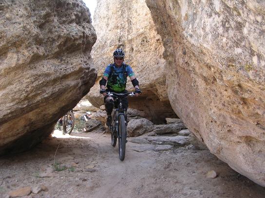
The group rode the South Rim Trail out and back and then took the Hidden Canyon trail back to the White Trail and back to the parking lot. Here is Bruce coming through some rocks on Hidden Canyon.
A bit more slick-rock. Bruce is in the foreground and Debbie is in the distance.
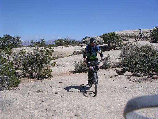
Not everything is slick-rock. There is a lot of it, but there are some "normal" trail sections in the interior of the mesa.
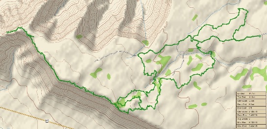
For the record, the graphic below shows the route and statistics. The ride was 11.8 miles with 2,427 feet of ascent. Notice how the trail hugs the edge of the mesa along the south rim.
After the ride, Quinton of OTE Sports treated the group to snacks and brats. OTE was a great host and served as convenient base of operations.
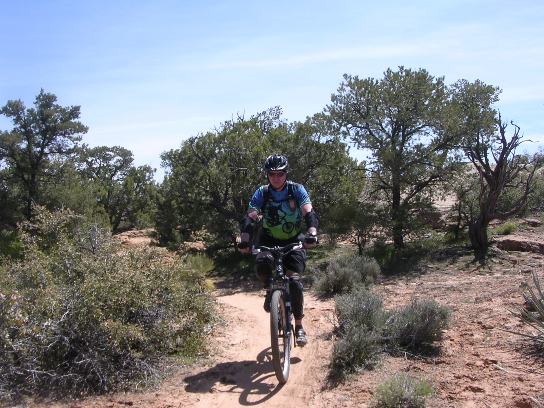
Day 1 was a blast, even if it was very difficult, and we still had Day 2 ahead of us. For the Day 2 ride, Bruce and his friends did the Gander Trail. Here is Bruce near the beginning. The Gander Trail is on the north-east side of the mesa and offers more spectacular views. This trail is rather typical of "regular" trails in its composition and there is very little slick rock to ride. However, it offers great views. Much better than South Rim.
Below is Rich, Monty, Bonnie and Tae, part of the group riding Gander.
Another photo of the group with Bonnie, Monty, Bruce, Alexandra and Rich.
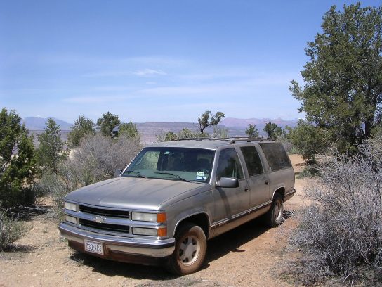
The mesa was dusty. At the end of the riding, everything needed a good cleaning, including Bruce's truck.
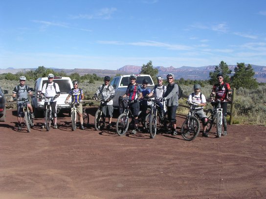
The trip was well worth it and Bruce is planning on going back in the fall to do it again. This time he will do the North Rim and Windmill trails. The Southern Nevada Mountain Biking Association (SNMBA) sponsored a day trip to Gooseberry on October 15th of 2011. The ride started out following the same route as the April 15th ride, but instead of returning via Hidden Canyon, took the White and North Rim trails. Below is a group shot of the SNMBA group at the start of the ride. Bruce is on the right.
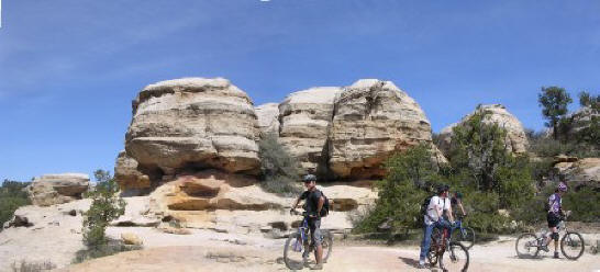
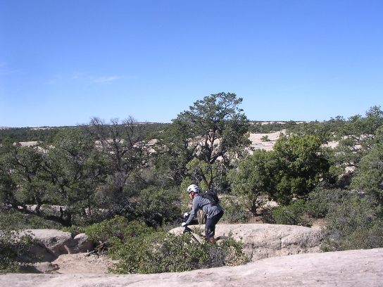
Here is a shot of Christian on one of the many slick rock climbs at the Mesa.
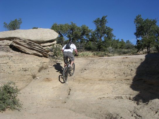
Here is one of the riders negotiating the slick rock on the way out to the South Rim.
Here is Bruce at the start of the South Rim Trail.
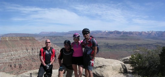
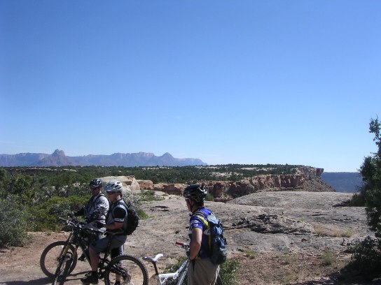
Here are some of the guys on the South Rim Trail out near The Point.
The South Rim Trail, as the name implies, follows the south rim making for a spectacular ride about 1,200' above the valley floor.
|
|
Version 0.3, October 15, 2011 |