|
Bruce
& Betsy Blais |
|
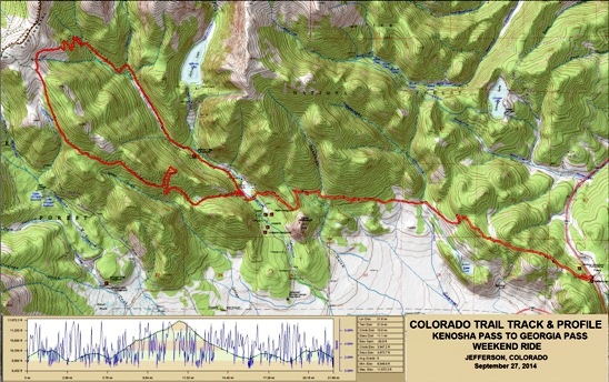
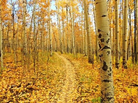
Mountain Biking - Special Trails - COLORADO TRAIL, COLORADO On September 27th, 2014, Bruce rode a section of the Colorado Trail between Kenosha Pass and Georgia Pass with Anne Taylor. This trail is located west of Denver near Breckenridge, well into the Colorado Rockies. The trail was high, fairly long, very technical is spots and had a lot of climbing. This trail is rated as intermediate to advanced by Colorado standards, and has a black diamond rating. It goes through a mixed forest of pine and aspen. The aspens were in full fall color. The vistas were magnificent, and he found himself stopping on a regular basis to take photographs. Below is a map showing the track, profile and statistics for the Colorado Trail ride between Kenosha Pass and Georgia Pass. This track and profile is for the clockwise direction around the west end. Reverse it for a counter-clockwise ride. Bruce and Anne rode up the Colorado Trail to Georgia Pass and back down the West Jefferson Trail. There seems to be no consensus on the preferred direction to ride it. You can right-click on the image below and use the "Save Target As" option to down-load a 1MB 11x17" PDF version of the map. You can also click on the image and zoom up to 200% for a detailed view in a separate window. Right click here to down load the GPX file for this ride. The file may want to save as an XML file, so if it does, change the extension to gpx before you save it. The file is a high-resolution track created on the Delorme PN-60W GPS.
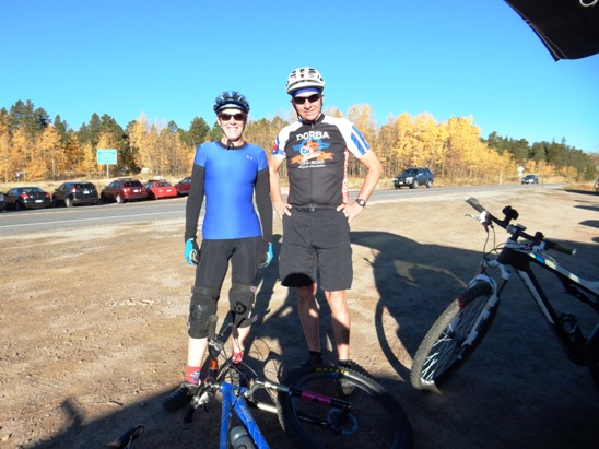
The distance ridden was 21.9 miles and the ride time was over 7 hours. The long ride time was due in part to the altitude, and in part by stopping for photos. Climbing was 3,974 feet, with most of it concentrated at the west end of the ride. There was also a good bit of climbing spread out across the entire ride. The average grade was 6% and the maximum elevation was 11,672' AMSL. This is the kind of trail on which you will use all your gears, and spend a lot of time in 1-1. The grades are not impossibly steep, but go on for some distance, making it necessary to slow down to a sustainable climbing pace. Ninety percent of the ride was above 10,000', and made for a very strenuous and demanding ride. Anne and Bruce preping at the Kenosha Pass trail head.
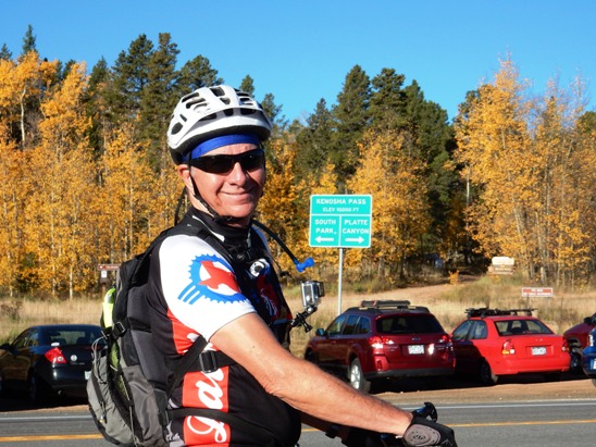
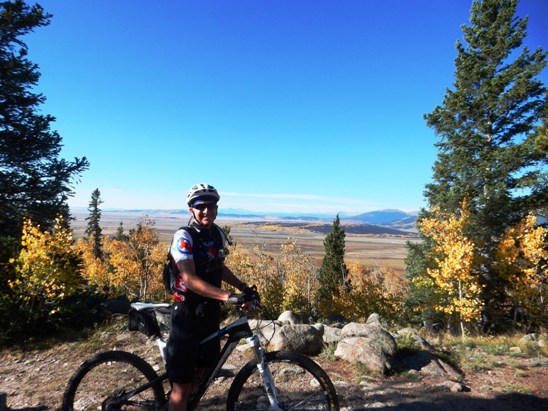
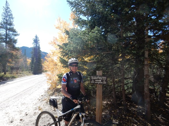
Below is Bruce ready to ride. Notice the elevation on the sign in the background. They started at 10,000'.
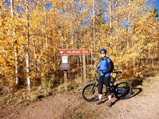
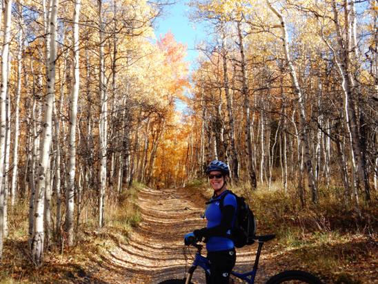
Anne just across the street at the entrance to the Colorado Trail. The Aspens were perfect.
Below is Bruce at one of the first over-looks after the initial climb.
A little further down, they came to a gorgeous view of the valley and the Heckendorf Ranch.
Another view of the valley further down. Lots of color here.
Below is Anne at one of the Forest Service roads you cross along the way.
At points, the trail looked like the Yellow Brick Road. Bruce found himself playing "Follow the Yellow Brick Road" in his mind as we rode along.
Below is Bruce at CR-37. At this point the Colorado Trail begins its long, technical climb to 11,672'.
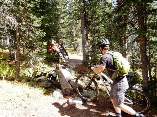
Below is Anne on one of the creek crossings. This was one of many creek crossings past CR-37. The approaches to the bridge were eroded, making it impossible to ride unless you could bunny hop up 24" while making a hard right turn.
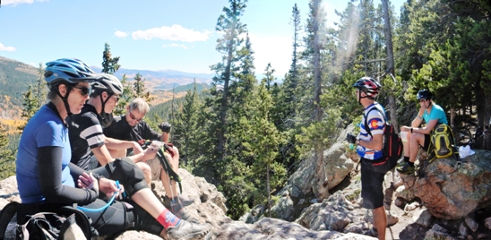
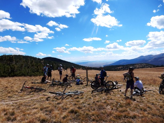
About half-way up the Colorado Trail side of the loop made by the Jefferson and Colorado Trails, they came to "Lunch Rocks". As you can see, the locals stop there for lunch on this ride.
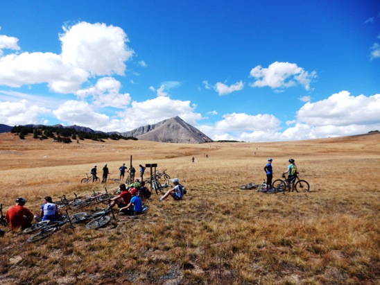
Finally at the top and at the tree-line. Elevation was 11,672'. That didn't seem to faze the locals. You can see a steady stream of riders coming up in the distance.
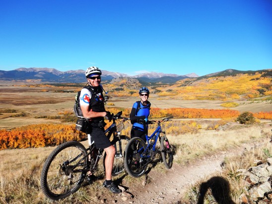
The Colorado Trail continues out and the West Jefferson turns right. The riders in the distance are on the Colorado Trail. Anne and a rider they met from Boulder are on the West Jefferson at the right of the photo below.
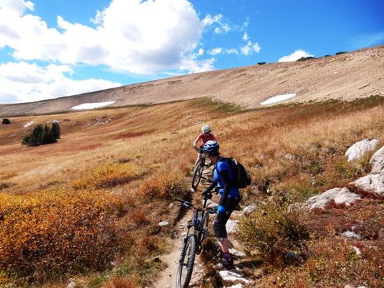
After a stop and some conversation at the trail intersection, it was back down the mountain on the West Jefferson Trail. Below is Anne and another rider on the upper end of the West Jefferson Trail. The trail was tricky to ride. It was off-camber and had no discernable "line". It reminded Bruce of a trail he would ride in the Vegas area named the "Twilight Zone". The trail made them feel like they were in another dimension.
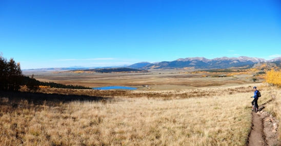
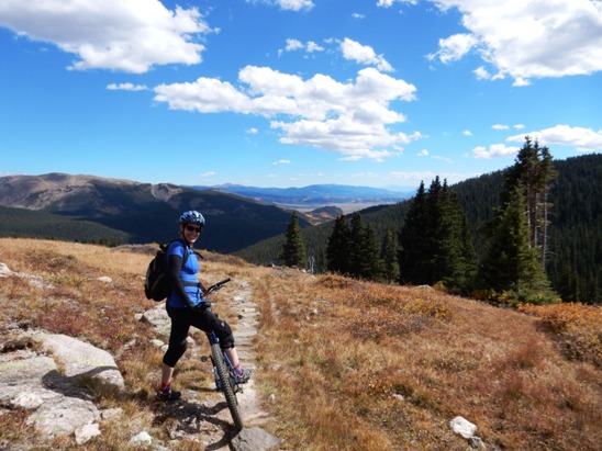
A little further down, Anne stopped for a photo op. They were still near 11,000' at this point. The mountains and valley in the distance show just how high up they were. The valley in the distance is at nearly 10,000'. This is REAL mountain biking.
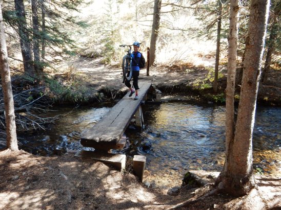
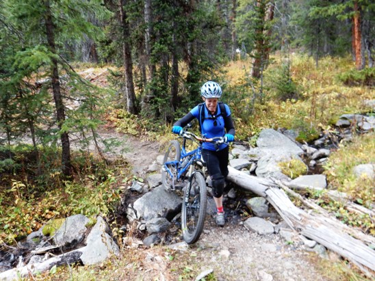
On the way back down the West Jefferson Trail, they had numerous creek crossings. Here is one where they had carry the bikes across a creek while balancing on a single log.
At the next creek, the bridge was rotted out and they had to walk across.
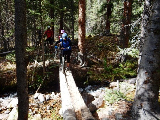
At the next creek crossing, they had the luxury of two logs to use. Below is Anne doing a balancing act while walking her bike across.
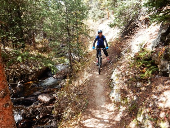
About half way down, the West Jefferson Trail followed the creek towards the bottom of the trail.
This ride is definitely one to make if you are in the area. The trail and altitude are going to tax your skills and endurance. It is not recommended you attempt this trail unless you are an advanced intermediate or expert rider.
|
|
Version 0.1, September 28, 2014 |