|
Bruce
& Betsy Blais |
|
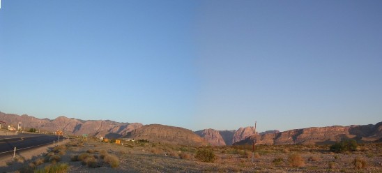
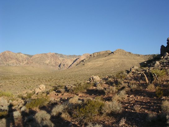
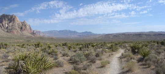
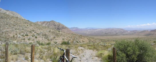
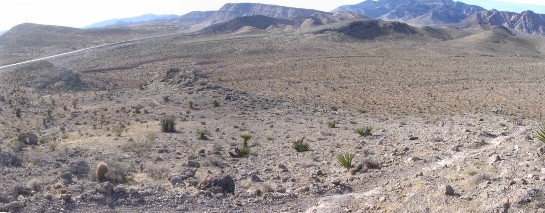
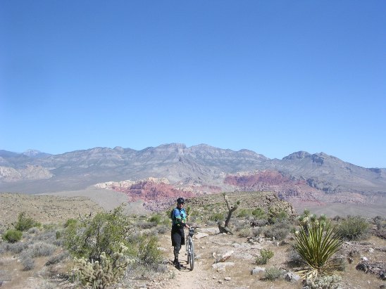
Mountain Biking - Special Trails - Red rock Canyon Bruce ended up working on an engineering project in Nevada and spent a lot of time in the Las Vegas area. While there, he rode the Red Rock Canyon trails extensively since they were only 20 minutes away from his condo. Visitors call this area Red Rock Canyon, but locals refer to it as Cottonwood Valley, which is correct since Cottonwood Valley is part of the Red Rock Canyon National Conservation Area. The panorama shows the approach to Red Rock Canyon from SH-160 near where SH-159 cuts off to Blue Diamond. He rode most of the area from the Blue Diamond trail head since this provided longer rides.
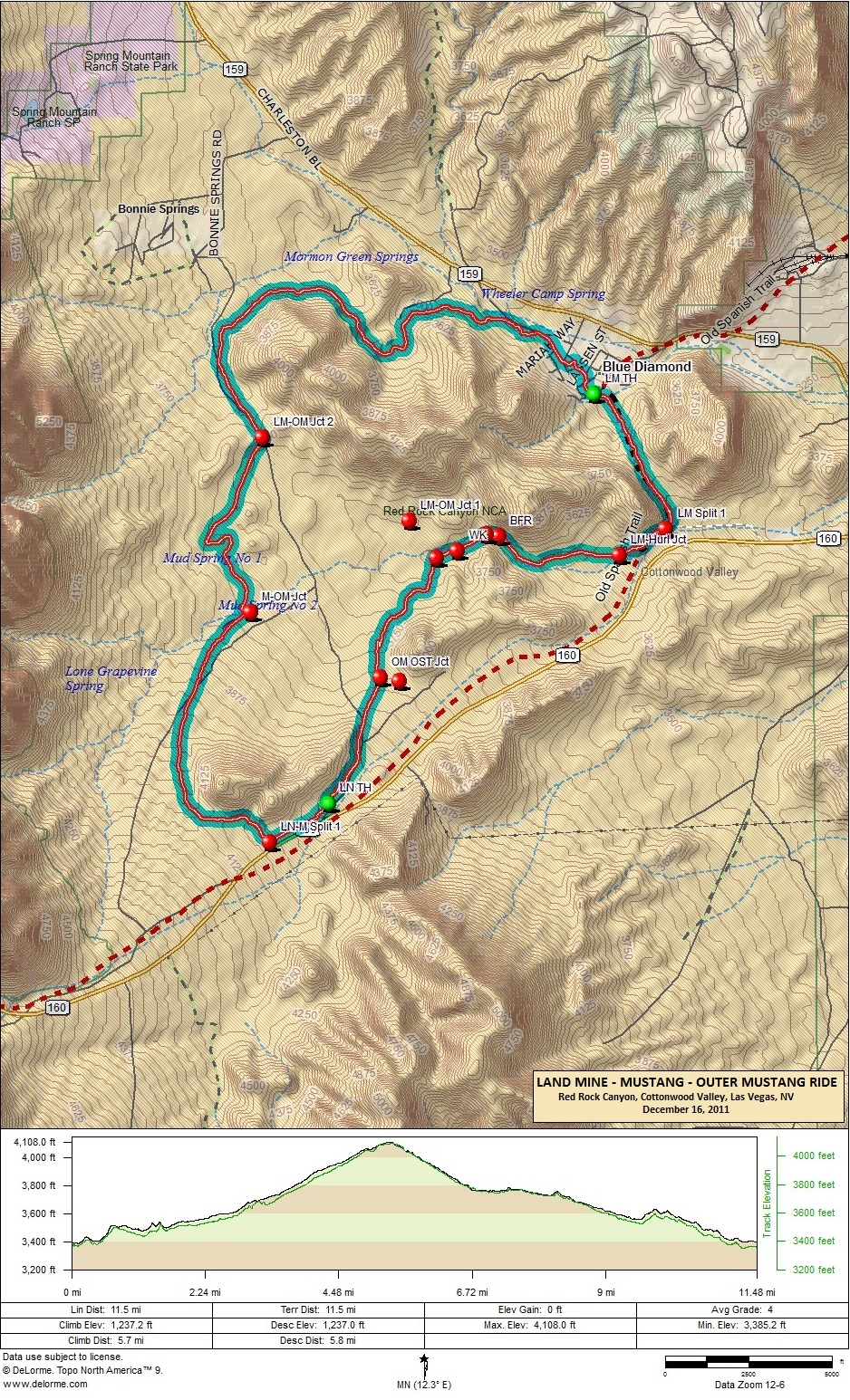
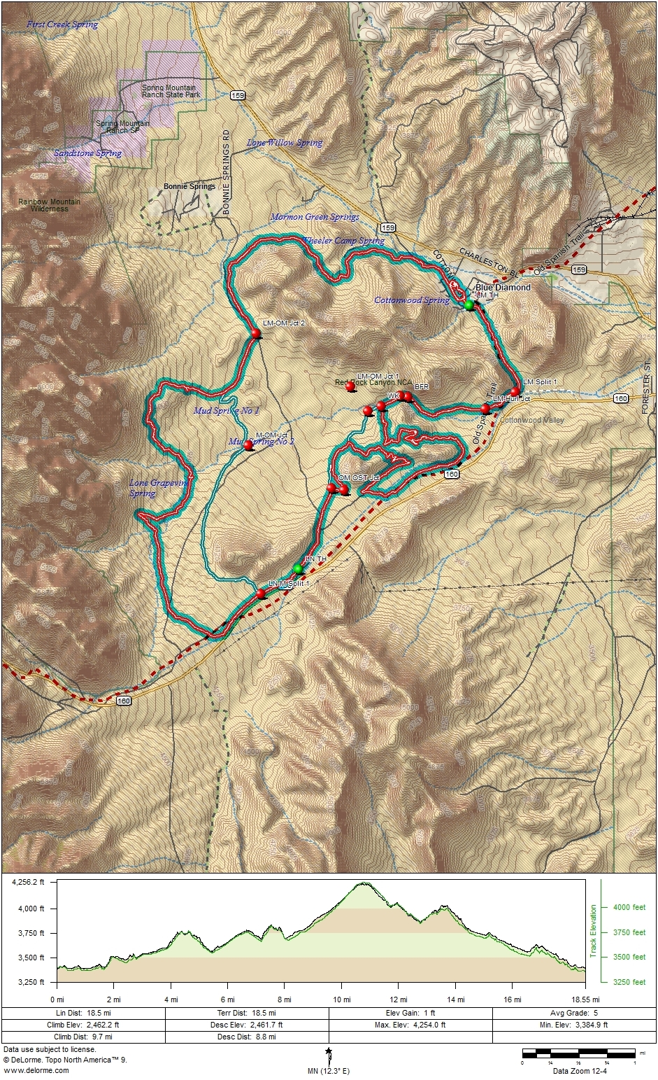
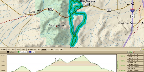
One of the nicest things about Cottonwood Valley in Red Rock Canyon is that there is a bike shop at the trail head. McGhie's Bike Outpost in Blue Diamond is just 2 blocks from the trail head. Chris Tuma, the shop manager has a good fleet of Trek, Cannondale and Fisher bikes set up to ride there. You can drive out to Blue Diamond, get fitted and be on the trail in 30 minutes. There is over 200 miles of single track in the valley. The difficulty ranges from beginner to single black diamond expert trails. The most difficult is the Hurl. The average ride is about 12-20 miles with 1,200' to 2,400' of ascent. Some of the longer rides reach 40 miles with over 4.000' of ascent. The first set of trails Bruce rode were north of Nevada SR-160 and included the Landmine, Mustang, and Late Night trails. The Land Mine - Mustang loop is very popular and the loop most renters ride. The loop is normally ridden clockwise from the trail head near McGhie's Bike Outpost in Blue Diamond. The track and profile for this ride are shown in the image below. The two green dots are the Blue Diamond Trail Head (BD TH) and Late Night Trail Head (LN TH). Right-click on the image below and use the "Save Target As " option to down-load a 1MB 8.5x11" JPG version of this map. You can also click on the image and zoom to 200% for a detailed view in a separate window. Right click here to down load the GPX file. The file will want to save as an XML file, so change the extension to gpx before you save it. The file is a high-resolution track created on the Delorme PN-60W GPS.
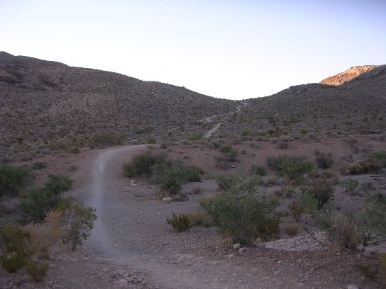
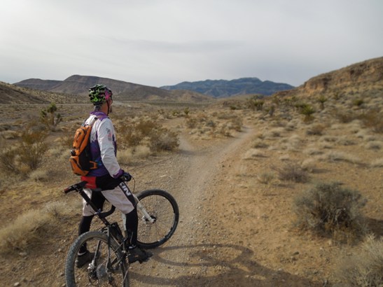
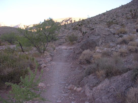
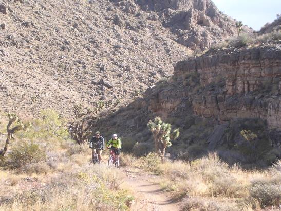
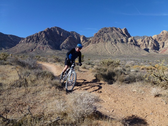
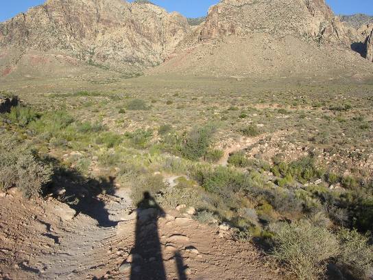
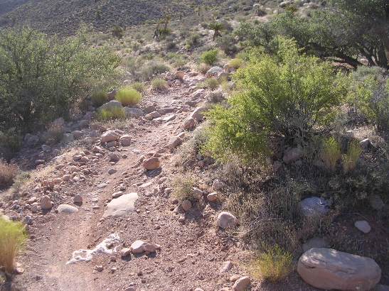
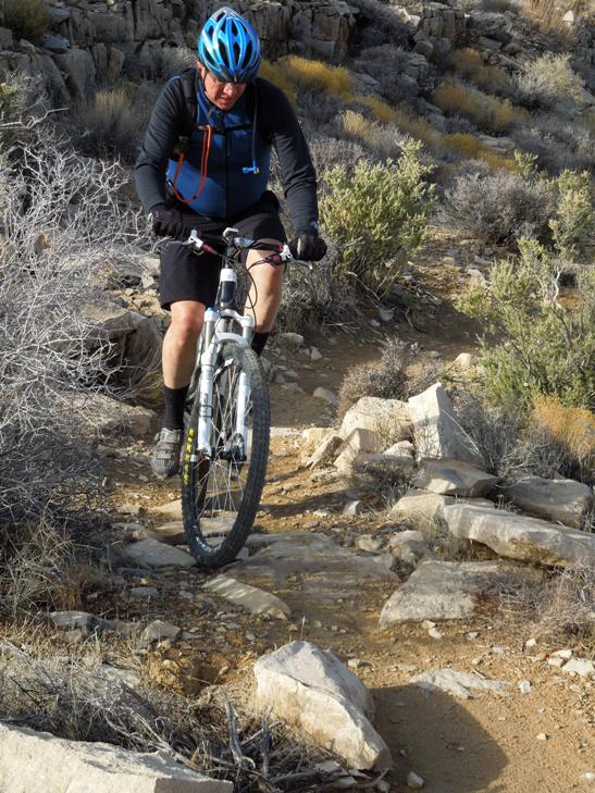
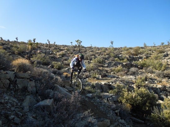
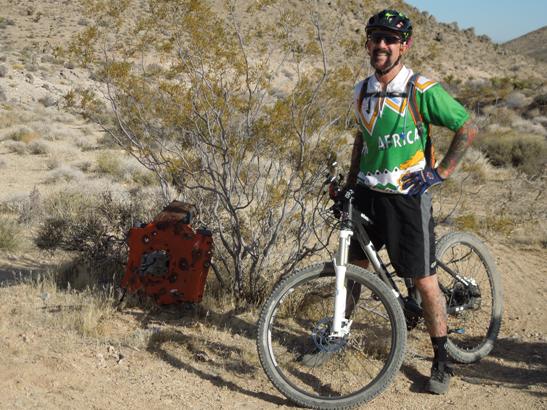
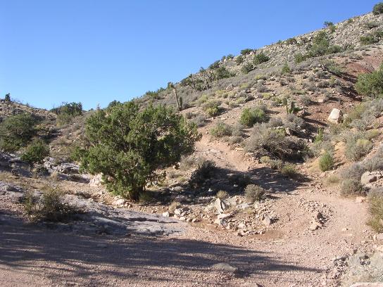
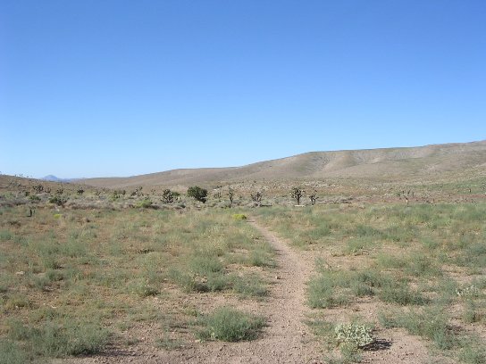
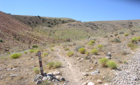
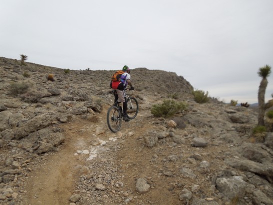
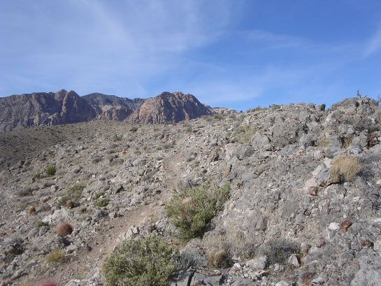
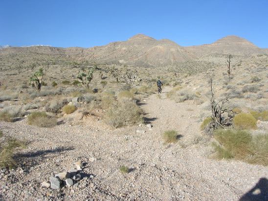
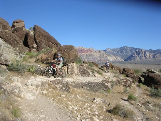
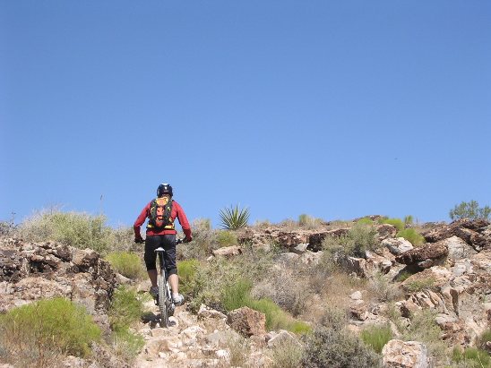
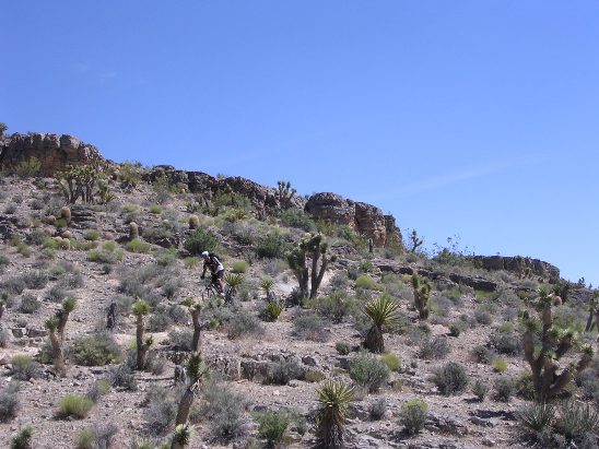
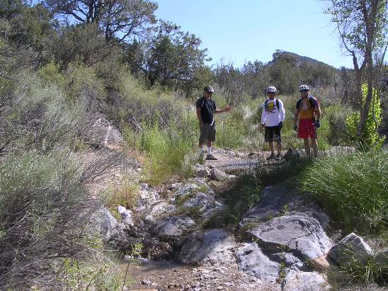
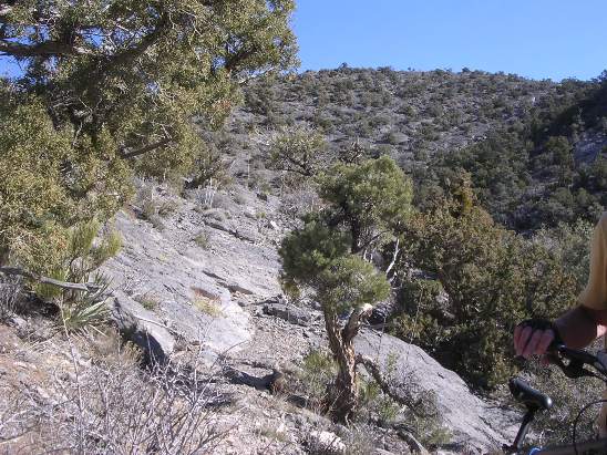
The length of this loop is just under 12 miles and it has about 1,240' of ascent. The elevation at Blue Diamond is 3,385', and it hits a maximum elevation of 4,108' just west of the Late Night trail head. The average grade is 4%. The initial climb from the trailhead is 200' in 0.4 miles, giving you a good "warm-up." The maximum grade on this climb is 22%, meaning you climb 22' for every 100' traveled. The photo below shows the climb from the Blue Diamond trail head. The maximum grade in near the top. This trail is called the "Welcome to Nevada" climb for first timers as it is the first good climb encountered, and it happens within sight of the trail head.
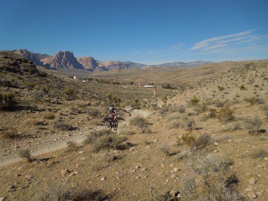
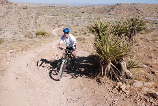
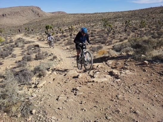
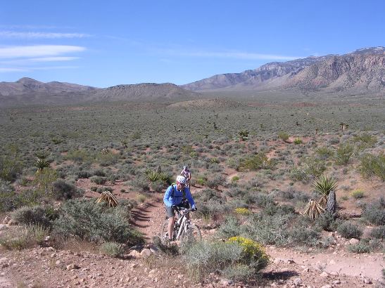
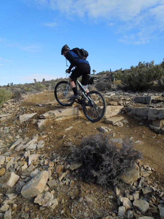
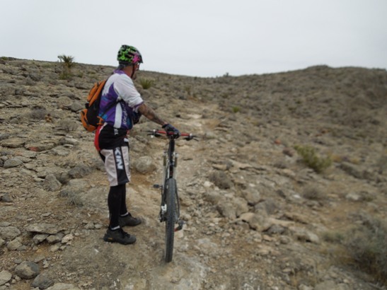
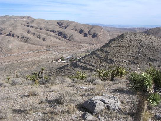
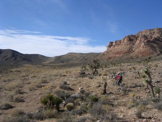
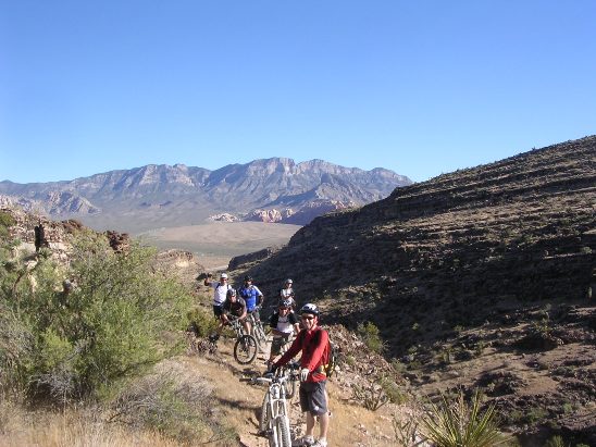
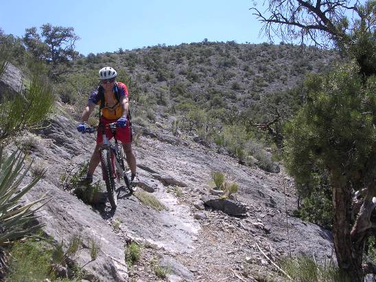
Below is a shot of Bonnie, a rider from the Dallas area, near the top of the climb. The community of Blue Diamond is in the distance.
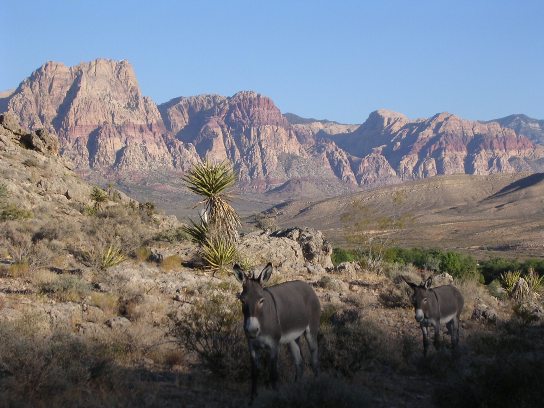
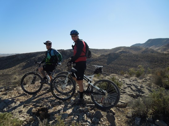
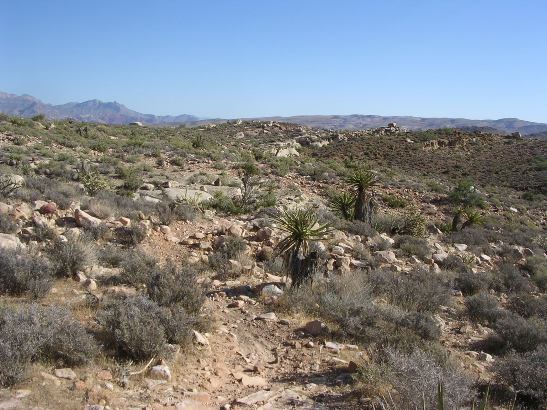
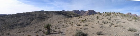
On one ride, Bruce came across some wild burros at the top of the climb. Burros are left over from the mining days a century ago and are common in the Conservation Area. The photo below is of the burros along the trail and of the magnificent vistas afforded from the trail.
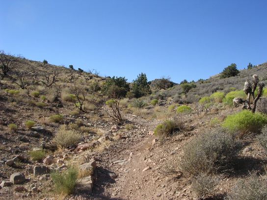
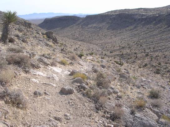
Down the trail, you come to a split. The right fork takes you up a climb and over the hill. The left fork takes you around the hill and down a drop. Both forks end up at the same junction beyond the hill.
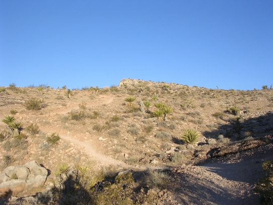
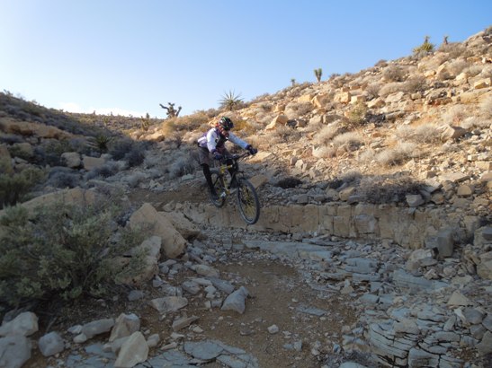
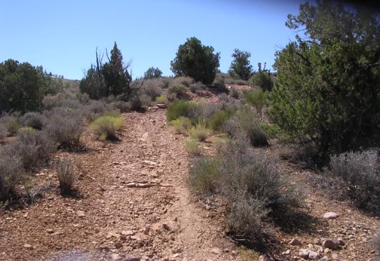
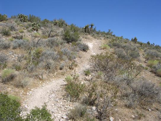
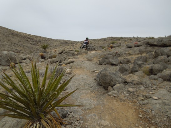
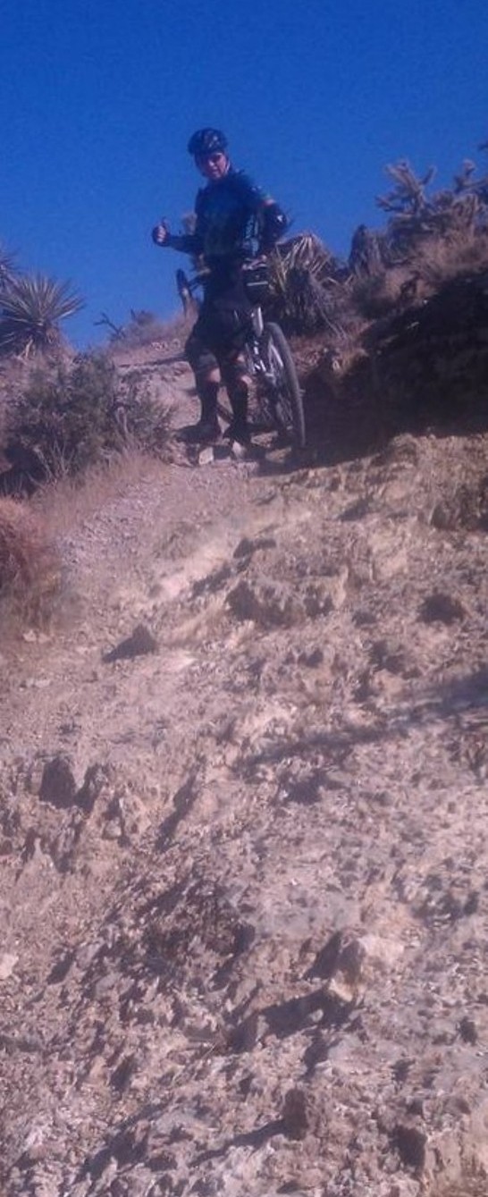
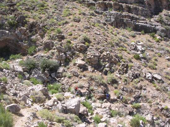
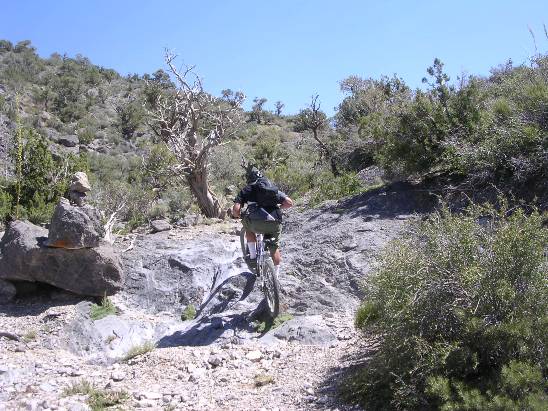
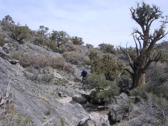
Further down the right fork you come to one of the more technical climbs on the "intermediate" section of the trail. Here is a shot from the bottom of the climb.
Below is a shot of Debi, from Switzerland, coming up the climb. Bruce can be seen down below waiting his turn to attempt the climb.
The climb is tough, but you are rewarded with a magnificent view from the top, and then a fun descent.
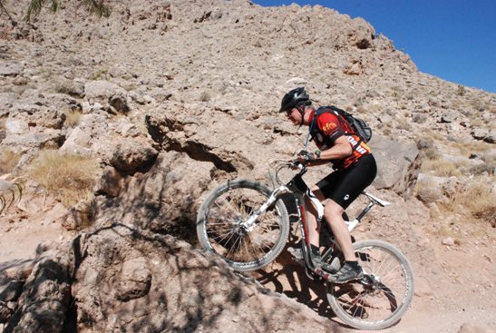
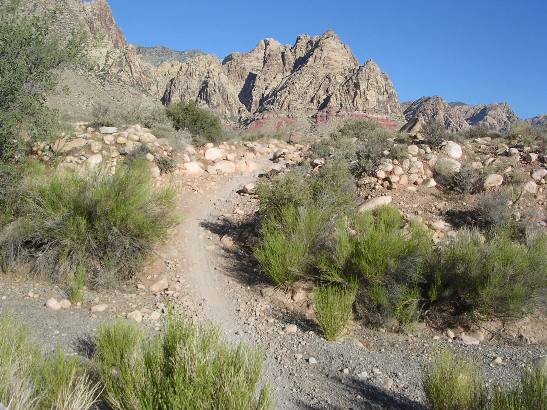
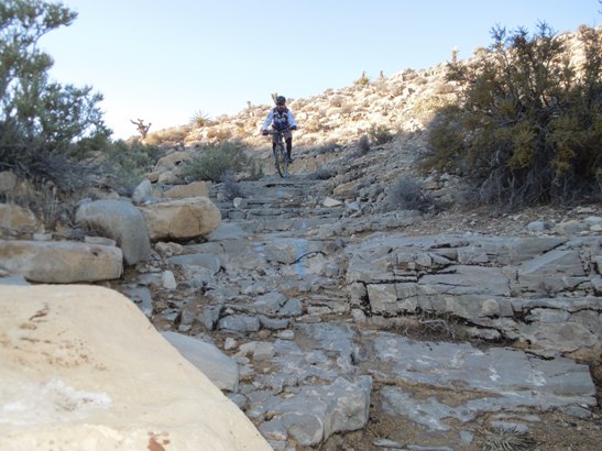
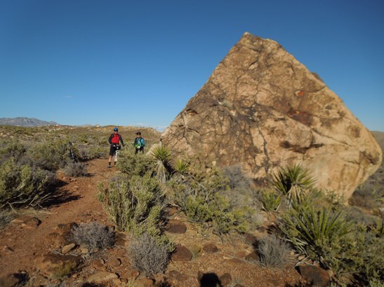
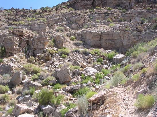
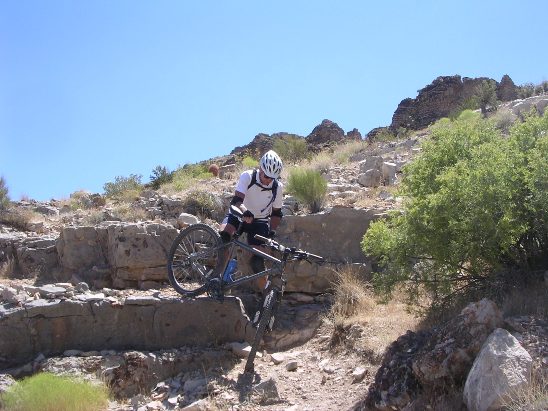
After the descent, you ride some fairly flat single track until you get to the BFR. The "B" stands for Big and the "R" stands for Rock. You can figure out the middle initial. The photo below shows the approach to BFR, which is much steeper than it appears in the photo.
It is a moderate challage for intermediate level riders. Here is a shot of Bruce climbing up and over BFR.
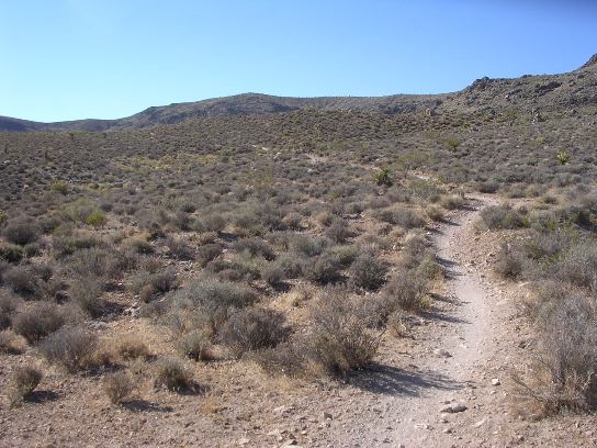
After the BFR, it's a cruise down a canyon and around some hills before beginning the climb to the parking lot and Late Night trail head on Nevada SR-160.
The shot below shows Juan and Jon rounding the hill and coming out of the canyon.
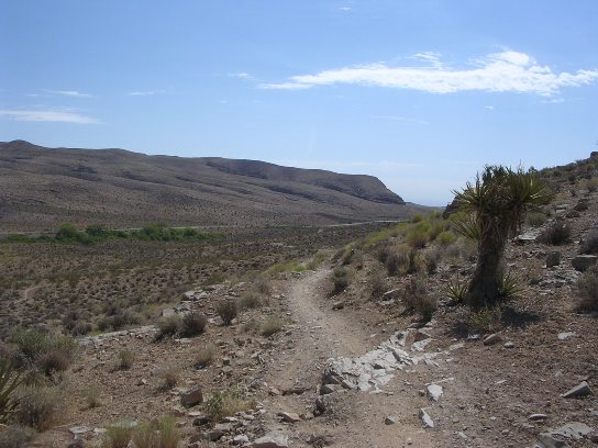
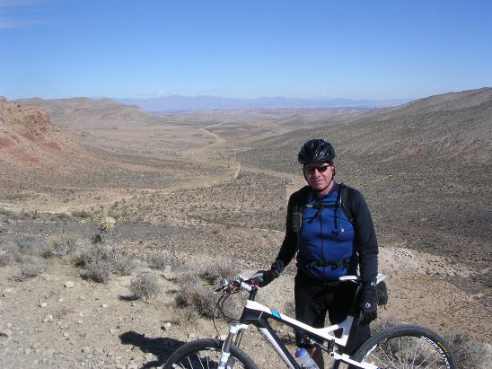
From this point, you follow the trail to the second junction and then bear left. After this, you climb three small hills. Below is shot of Bruce at the top of the first hill. The canyon in the photo above can be seen in the distance.
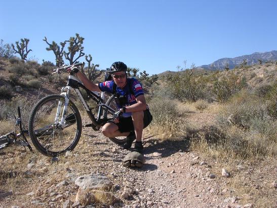
After the three hills, it down through a wash and on up to the Late Night trail head. Along the way you occasionally encounter some protected wildlife. Here is Bruce with an endangered desert tortoise. As protected wildlife in a conservation are, its "hands off".
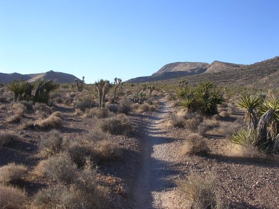
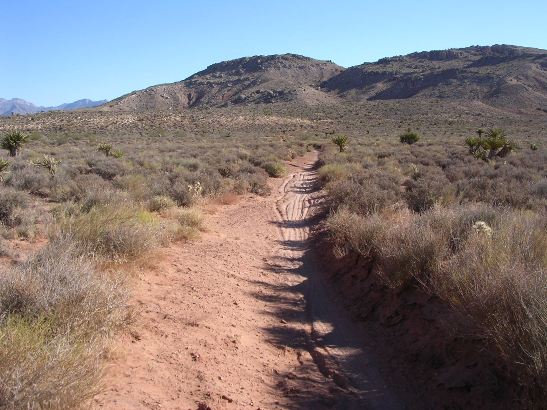
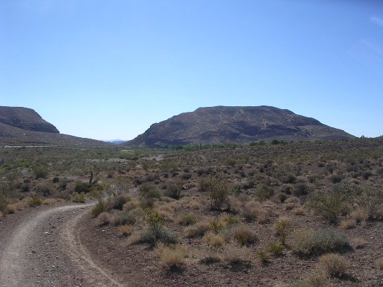
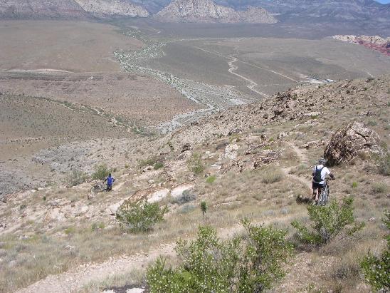
Below is a shot of the long, gradual 2-mile 380' climb to the Late Night trail head.
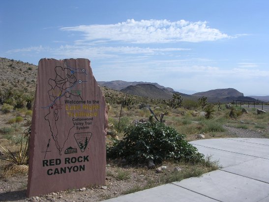
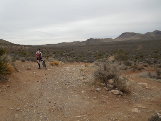
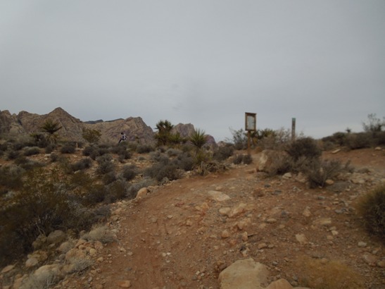
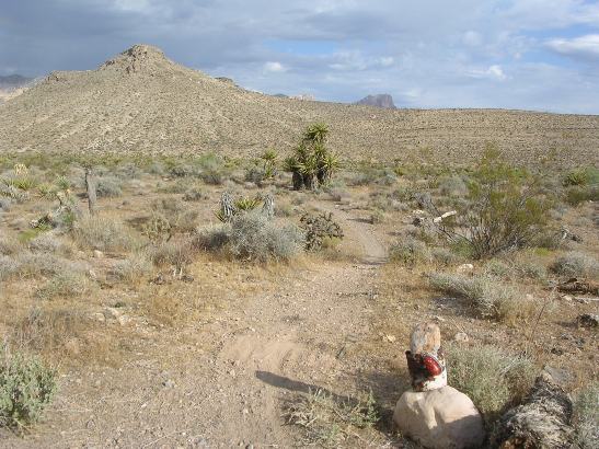
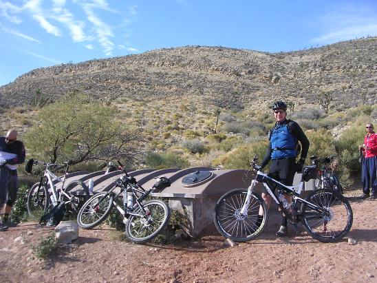
At the end of the climb you arrive at the Late Night trail head where there is the parking lot, restrooms and a nice trail map stone carving.
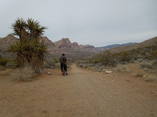
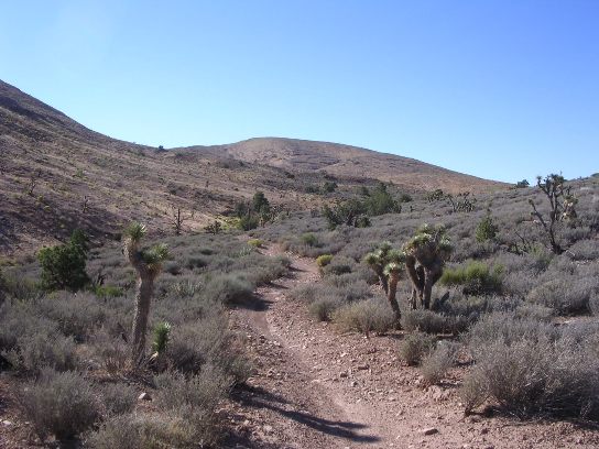
Next, you travel west from the parking up the Mustang/Late Night Trail. About a half-mile up, you reach the junction where the Mustang Trail branches off to the north.
Shortly after entering Mustang, you begin a 2-mile, 400' descent to the valley floor. It is quite a run, much like a bobsled run on a mountain bike. The the locals call this long and exciting descent into the valley "Viagra" for obvious reasons.
Here is a shot of Bruce coming down. Viagra is a "chain ring 3" run. When conditions are good, you can get into 3-9 an hit 30+ MPH in the dirt.
At the end of Viagra you come to a three-way junction. The options are to take right fork back to the Light Night trail head on the Mustang Loop, continue straight and take the cutoff back to BFR, or go left down through the wash to the Outer Mustang Loop. Here is Preston at the junction heading towards Outer Mustang.
The trip down into the wash at the start of Outer Mustang is a bit loose.
While the trip down is gravel and loose. The climb out is rocky.
A ways beyond the wash, you come to "Little Daytona", a straight, smooth, downhill section that is another chain ring 3, top gear run. The trail is the most fun after rain when it is packed down firm. Here it is in its normal, dry, loose state. Even in this condition, it is still possible to hit 30+ MPH in the dirt.
At the end of "Little Daytona" you come to a small climb and kiosk. Below is a couple of riders finishing up a run down "Little Daytona" and climbing up to the kiosk.
Here is a shot of the kiosk at the top of the hill.
Following the trail to the right takes you back to BFR. Left takes you down Outer Mustang to Blue Diamond. Here is a rider taking a break before another fast descent.
At the bottom of the run, you encounter a long rock garden. Initially, it is loose and sandy. This is a hard, tricky ride because the traction is poor and the rocks tend to steer you, making for a real skills challenge.
Later on the sand and rock gives way to mostly rock.
After the rock gardens, it is a bit more rocky climbing.
The final leg. Blue Diamond and the finish are just around the corner and across a couple of washes. The washes are like a roller coaster ride on a mountain bike.
Ahead, Blue Diamond sits like a green oasis in the desert, and the ride is just about complete.
Even though this is a 12 mile loop, the climbs and rocks make it a 1.5 hour ordeal for the average rider. And this is the "easy" trail. Landmine-Wounded Knee-Late Night-Black Velvet An intermediate to expert variation to the Landmine-Mustang loop can be done by including the Wounded Knee, Lawn Mower, Late Night and Black Velvet trails. The track and profile for this variation is shown in the image below, overlaying the normal Landmine-Mustang-Outer Mustang described above. The Wounded Knee and Lawn Mower sections are the loop to the south-east, and the Late Night and Black Velvet sections are up against the mountains west of the Mustang Trail. Being up against the mountains results much more rugged terrain, making these two trails much tougher than most of the other trails in the valley. All four of these sections are advanced intermediate to expert level trails, and are definitely not recommended for beginners.
For folks renting bikes, this route is also normally ridden from the trail head near McGhie's Bike Outpost in Blue Diamond. The two green dots are the Blue Diamond Trail Head (BD TH) and Late Night Trail Head (LN TH). Right-click on the image above and use the "Save Target As " option to down-load a 2MB 11x17" JPG version of this map. You can also click on the image and zoom to 200% for a detailed view in a separate window. Right click here for the GPX file. The file will want to save as an XML file, so change the extension to gpx before you save it. The length of this loop is just under 20 miles and it has about 2,465' of ascent. The elevation at Blue Diamond is 3,385', and this ride hits a maximum elevation of 4,254' compared to 4,108' for the Landmine-Mustang loop. The high spot is in the southwest corner of the map where the GPS track comes up against the foot of the mountain near its crossing with the Jeep road. The average grade on this loop is 5% compared to 4% for the Landmine-Mustang loop. The Wounded Knee, Lawn Mower, Late Night and Black Velvet sections are advanced intermediate to expert level trails, and are definitely not for beginners. This ride follows the Landmine trail across BFR and then turns left at the first intersection as you exit the canyon on to the Wounded Knee Trail. When you turn left, you enter another canyon and begin a climb to the top of hill. The trail twists and turns through the rocks. Below is a shot of Bruce on the climb up to the top of the hill.
There are a number of ledges to clear along the way. Here is Bruce climbing the last big one near the top.
The rest of the climb to the summit is fairly easy. Here is Tate and Bruce at the top.
Next, it's down the backside to the "Waterfall". Here is Preston negotiating a rocky turn and drop.
After a couple of descending switchbacks it's down the rocky descent the locals call the "Waterfall". Below is Preston dropping off the first ledge.
Next, it's down the "Waterfall".
Use this link to see a short video of Bruce descending the "Waterfall". This is a full HD video, so watch it full screen for best results. Lawnmower Trail After Wounded Knee and the "Waterfall", you follow the trail south to the Old Spanish Trail and then west to the cut-off to the Lawnmower Trail. The cut-off goes right (north) and is marked by rock marker and clearance light from a truck.
This is a long, steep switchback climb. The trail gets it's name from an old lawnmower marking the entrance to the trail. Below is a shot of Preston and the lawnmower at the entrance to the trail.
Late Night Trail The Late Night Trail starts outs looking fairly routine as you can see below.
A little further in things start to get a little rough.
The further in you go, the rougher things get. The rocks keep getting larger.
At the end of Late Night, you cut off onto Black Velvet. Black Velvet The Black Velvet Trail picks up where Late Night leaves off in terms of difficulty. It is several miles across rocky terrain like that shown below.
Below is a shot of Bruce and Tate next to one of the rocks along the trail. This rock came down off the cliff. Glad no one was around when it did.
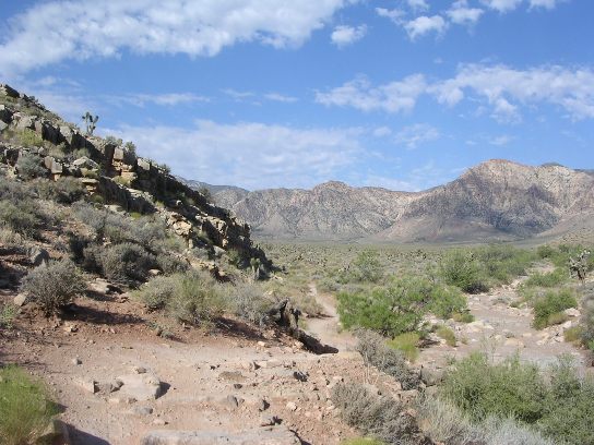
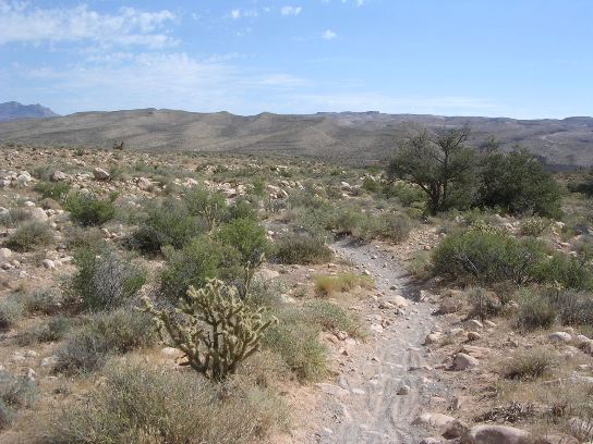
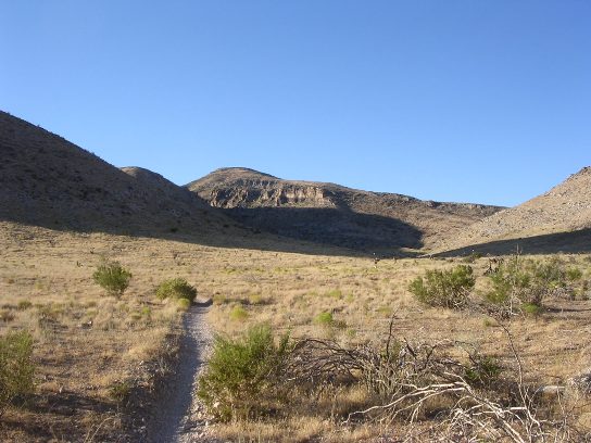
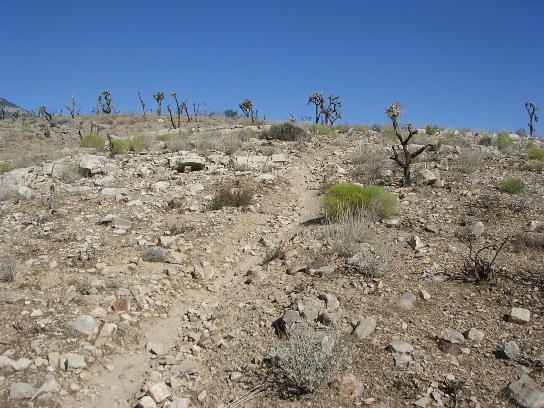
Badger Pass - Dead Horse Trails After riding north of SR-160 and becoming familiar with the conditions, he decided to try the south side of Cottonwood Valley. The Badger Pass and Dead Horse trails are the primary trails on the south side. Badger is an intermediate-level trail, and parts of Dead Horse are considered advanced due to its demanding climbs and technical features. The climb from the trailhead at SR-160 on the Badger Pass trail to its intersection with the Dead Horse trail is 640' in 3.4 miles. This climb is nearly continuous, going on mile after mile. The photo below shows the beginning of the climb.
After 2.5 miles of climbing, you are still going up. It is all up-hill and there are no level sections giving you a break.
At the intersection of Badger and Dead Horse, you encounter a series of steep, rocky down-hill switch backs and end up at a wash at the bottom. The switch-backs have sharp rocky turns and give the long wheelbase of an XL 29er a fit. Here, he encountered the first standing water in nearly 6 weeks of riding.
Now it was time to give back all of the down-hill and start climbing again.
Here is a photo of the second climb looking back. This gives you an idea of the amount of climbing involved. While the trail is mostly dirt, there are enough loose rocks to keep you maneuvering for a good line.
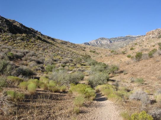
And you are not done yet. The photo below shows what lies ahead. More climbing!
After climbing 300' in about a mile and a half, you reach the "plateau" and can catch a break.
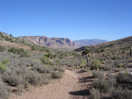
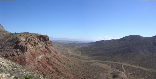
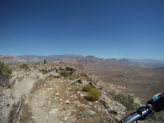
After riding two miles across the plateau, you reach Wilson Tank. The view from the 4,600' elevation is spectacular. Las Vegas can be seen in the distance on the horizon.
Wilson Tank is the "turn-around point" on Dead Horse. The way back along the mountains is much more technical than the ride out as can be seen from the photo below.
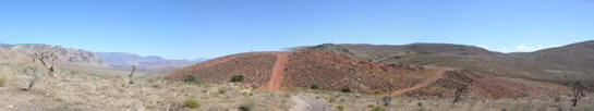
After crossing a rougher section of the "plateau", you come to a red hill and steep descent.
The steep descent has rocky, sharp switchbacks that also challenged the XL 29er. This section of trail is called "Satan's Escalator" and the photo below gives a view looking back up at it.
The remainder of the Dead Horse Loop has numerous rocky descents and climbs before you get to the final descent. Here is shot of one of the descents.
And here is one of the climbs.
At the top of the last climb, you get a spectacular view of the final descent to the trailhead.
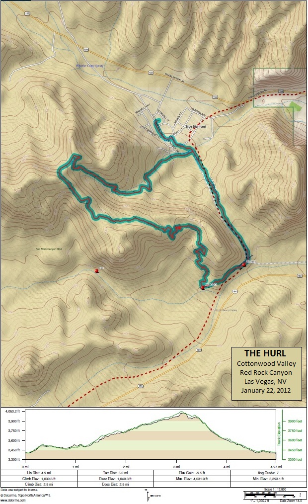
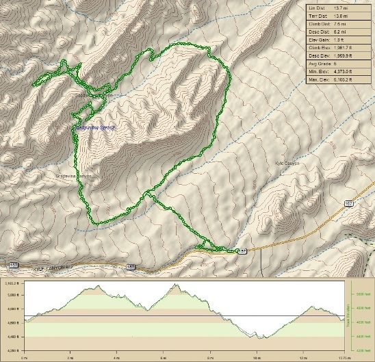
The descent is long and rocky and loose in parts, so you need to control your speed. However, you end up being on the brakes so long, you end up looking for low gear and engine braking. The Hurl is one of the most technical trails in the Cottonwood Valley section of Red Rock Canyon. It is a short trail at 6.2 miles, but has nearly 1,200 ft of climbing. The average grade is a 7, compared to a 4 for most of the rest of the trails at Cottonwood. Some parts of the trail have a 25% grade. Right-click on the image below and use the "Save Target As " option to down-load a 3MB 11x17" version of this map. Right click here to down load the GPX file. The file will want to save as an XML file, so change the extension to gpx before you save it. The file is a high-resolution track created on the Delorme PN-60W GPS.
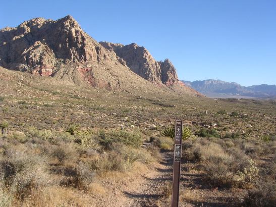
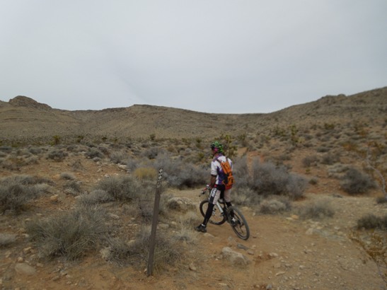
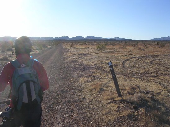
The Hurl can be ridden in two directions. The first access point is from the Land Mine trail at the top of the climb up from Blue Diamond. The second is from the Land Mine Trail about a mile further out. This point is marked with the second red dot traveling clockwise on the loop in the map above. Riding the trail in a clockwise direction is more difficult because it means you climb rather than descend the steep rocky sections. The trail marker at the south entrance is shown in the photo below.
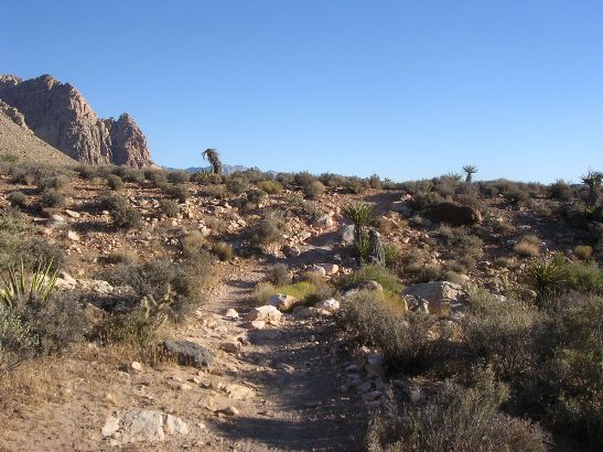
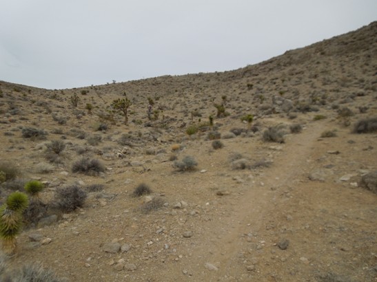
Initially, the trail looks innocent enough, but this is deceptive.
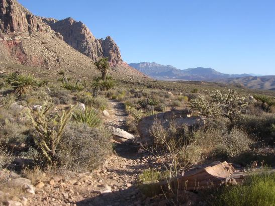
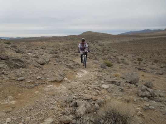
After some twisting and turning, you start to encounter rock.
Before long, the trail turns right, gets steeper, becomes all rock, making the climbing a bear. This climb presents itself after you have done several "normal" climbs. The photo below shows Preston on the first technical climb.
After a couple hundred feet of climbing the rock, the trail turns left and continues climbing.
Below is a shot of Preston on the third leg of the rocky, switch-back climb. The rocks momentarily interrupted his progress, but he got back on and rode it out.
Preston finally gives out near the top of this climb, taking a seat on his top tube.
The photos don't show it, but several sections on the climb are a 25% grade. That is 25' of climbing for ever 100' of trail, very rocky trail! On top, you have a spectacular view of valley. This one is looking south-west towards the Late Night trailhead.
At this point, you still haven't reached the top. There is still a bit of climbing to go as you can see below.
Once past the top, you reach an area where you can see Blue Diamond (your starting point) below.
As you start down, the scenery looking back is quite spectacular.
Now comes the scary part. The ride up tested your physical endurance. The ride down is really going to test your skills in negotiating rocky descents.
The penalty for failure here is quite "steep" as you can see on the right. In addition to being rugged, it is also very loose. It's all the way down the hillside, through the canyon and back to the starting point. At the end, you are simply grateful to have survived the experience. Riding Bonnie & Clyde from from Blue Diamond is a challenge. The loop is just over 35 miles in length and has 3,830' of ascent. The track and profile is shown below.
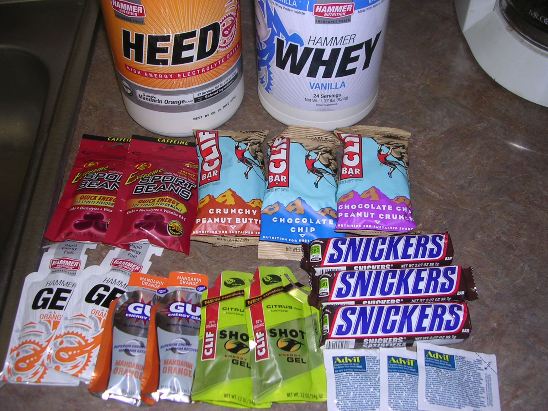
Since this was going to be a long ride, proper nourishment and supplements were going to be a must. The photo below shows the "stash" for the Camelbak. The Heed, supplemented with Endurolyte powder. was the hydration. He got an assortment of other items to try out for endurance riding.
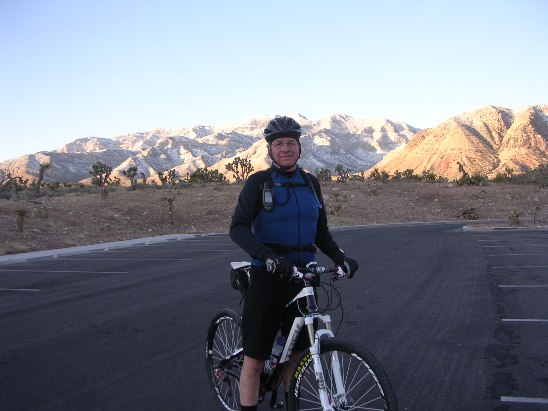
The ride started out at the parking lot for the Late Night trail head. The mountains got a "dusting" of snow that morning. Bruce, wanting it to be more, started at Blue Diamond, which added 12 miles and about 1200' of ascent to the "official" ride.
Parts of Bonnie & Clyde follow jeep trails or double track.
Other parts of the trail are for ATVs.
And then there is quite a bit of single track.
At about the 40% point, you come to Wilson's Tank. This is a pair of spring-fed covered livestock tanks.
After Wilson's Tank, it's around the end of the mountain and up on top. Below is Bruce on top. Wilson Tank is just over the edge and in the valley below.
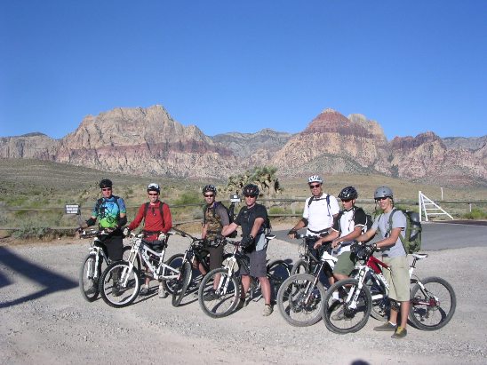
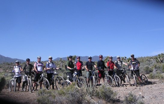
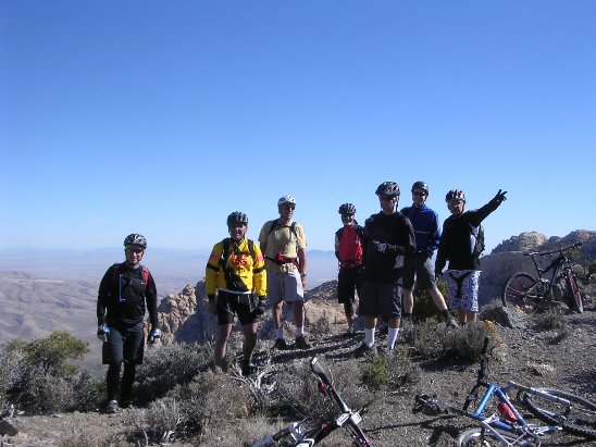
All in all, it was a very strenuous ride, one that he plans to do again. The Cowboy Trails are in the Red Rock National Conservation Area north of Cottonwood Valley up at the equestrian area. These are some of the most technical trails in the area, and are considered "Advanced" or "Expert" trails. As you can see from the group photo below, most riders bring their "all mountain" bikes with the long travel suspensions for this ride, and they really need it on parts of the trail.
Like so many trails in Red Rock, it seems you go up a couple thousand feet to get to the real fun. This trail is no different. There is over 2,000' of climbing to the top.
The photo below shows the group stopping for a break about half-way up.
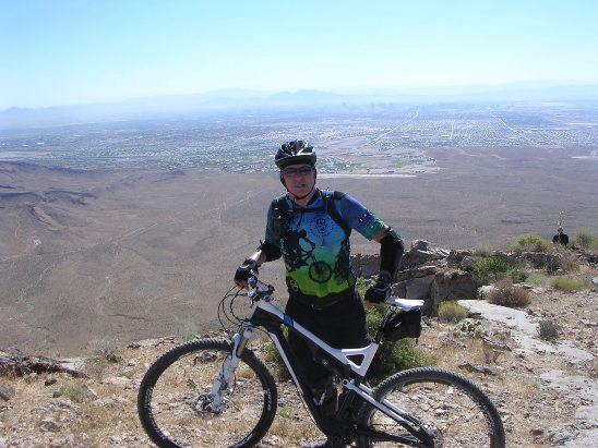
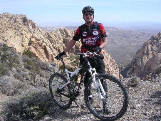
The ride up was a grind, over 2,000' of grinding to be exact. Below is a photo of Bruce on top after the initial climb with Las Vegas in the distance below.
At this point, things started getting really gnarly. It seemed to start out OK, but that didn't last long.
Before you knew it, you were hopping or dropping ledges every 50' or so. In the photo below, the trail goes up the ledge on the left.
Where there weren't ledges, it was rock. The photo below shows Mark negotiating a rocky climb up on top.
Bruce got his fill of rocky climbs this day. The photo below was taken by Steve as Bruce gave out near the top of one climb. Steve said to turn and look good regardless of the fact we were dying here. Steve's motto is "It is better to look good than to feel good."
After the rocky climbs came the rocky descents. In the bottom of the photo below you can make out Mark in red negotiating a rocky descent. If you look closely, you can see the other riders in the rocks. They are actually on the trail in the rocks.
The photo below gives a close-up of the trail Mark was on in the photo above. Some rode this section of trail, most walked.
Not everyone was able to ride this stuff. Below is Steve "negotiating" one of the turns. Some of the guys actually rode these drops. Most walked.
Once through the rocky areas, is was a long, relatively smooth and steep descent into the valley and on back to the parking lot.
Afterwards, Steve and Bruce agreed they would not do this again, or so they said. About 5 miles out Kyle Canyon Road from US-95, there is a gravel parking lot on the right side of the road that is the trail head for the Twilight Zone Trail. This is a short, brutal 13.8 mile trail with 1,962' of ascent. It seems most trails in this area have about 2,000' of climbing. The orgin of the trail's name in unclear, but after riding it, Bruce is convinced that it comes from off-camber bench-cuts, loose conditions and deceptive climbs and descents. It just doesn't ride like any other trail in the area. Climbs and lines are difficult to judge, making you feel like you are in a land of substance and shadows, another dimension, or the Twilight Zone.
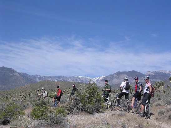
Here is a photo of the group for the June, 2011 ride minus the photographer, Bruce.
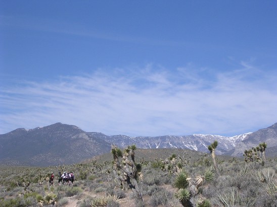
The better riders, or "hammer-heads," quickly out-paced the rest of the group. It is June and there is still snow in the mountains.
Another photo of the riders regrouping on the trail.
Below is a photo of Steve coming down across a ledge on the trail.
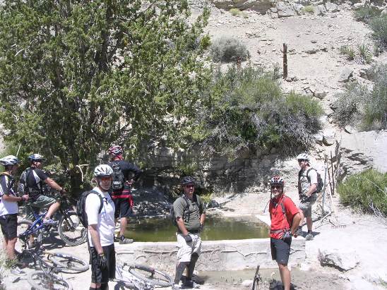
One of the springs coming out of the mountain awaited at the furthest point of the ride. This one had been made into a live-stock tank. From here, it was back to the parking lot.
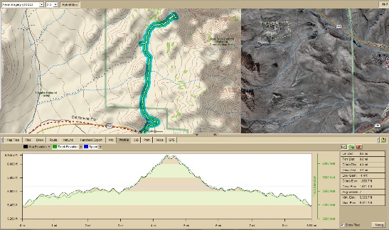
The trail demanded total and complete focus along most of the way. As a result, there were not very many photo opportunities. The Mountain Spring Trail is not on any "official" trail maps, and was "discovered" by local knowledge. The track and profile below show the ride.
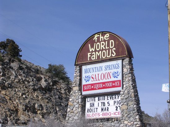
The overall ride is 4.4 miles but the first 3 miles are on a jeep road. The single-track is the last mile and a half as is most of the climbing. The total climbing is 1,670' and the average grade is a 7. The maximum elevation is 6,120' and is reached just before the edge of the cliffs. The trail starts off a jeep road leading out of Mt. Spring, but is usually ridden from the parking lot of the historic Mt. Springs Saloon. The saloon is a popular gathering point for motorcycle riders and offers everything needed: liquor, food, ice and slots.
Shortly after leaving the Jeep road, you can take a slight diversion and visit one of the springs coming out of the mountains.
From there, the climbing gets tough in places. Below is Brandon negotiating a rocky climb.
It's a haul, but eventually, you get to the top and are rewarded by a fantastic view of Cottonwood Valley. Below is the group from the January 2011 ride at the top.
Below is Bruce with his now deceased Gary Fisher Superfly 100.
The way down is the same as the way up. The photo below shows what the trail looks like near the top coming down.
The terrain looks harmless enough until you try riding down it.
The further down you go, the more boulders you have to maneuver around.
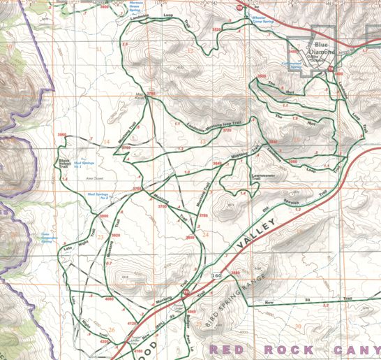
While this is a short ride, it is one of the most challenging and technical rides in the area. There are two sets of maps and profiles for the Cottonwood Valley trails at Red Rock Canyon. The map below shows the trails on the north side of Cottonwood Valley. Below that is the map and profile for the south side. These map sections came from a Green Trails Map. If you are headed out that way, order one off the web or pick one up at a local bike shop. You have a couple of options when riding the trails on the north side. You can start at the Blue Diamond trail head shown by the red trail head dot in the upper right-hand corner of the map. I normally start here on the weekends when not riding the south side. You can also start the trail head on NV-160 shown by the ret trail head dot at the bottom center of the map. I normally ride from there on weekday evenings.
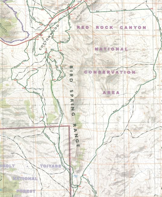
The map section for the Badger - Dead Horse ride is shown below. The ride starts at the trail head marked by the red dot near the top - center of the map and proceeds south along the west side of the Bird Spring Mt. Range. The turn around is at the bottom of the map and you follow the green and black line back to the road and eventually to where you started.
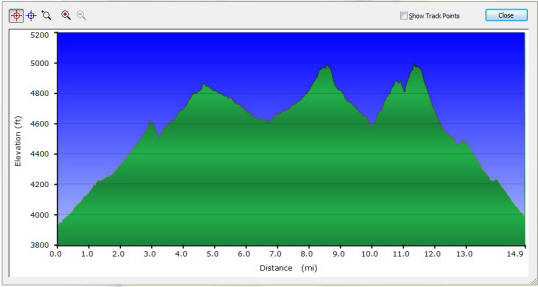
Badger Pass - Dead Horse Track & Profile The image below shows the profile for a round trip ride of the Badger Pass and Dead Horse trails. The overall length of the ride is 15.6 mi. on the cycling computer with a total climbing height of 1,753 feet on the GPS receiver.
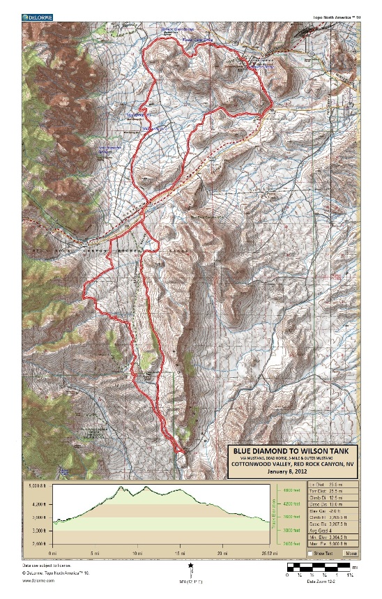
The elevation at the start of the ride is 3,940' above sea level, and on the two peaks near the end of the ride, you hit 5,000'. The first 5 miles give you over 1,000' of nearly continuous climbing. There is some brutal climbing near the end of the ride, and the last 3 miles are mostly down hill. The locals call it the "3 mile smile". Blue Diamond - Wilson Tank The track and profile for the combined north and south-side trail ride are shown in the image below. Right-click on the image below and use the "Save Target As " option to down-load a 1MB 11x17" PDF version of this map. You can also click on the image and zoom to 200% for a detailed view in a separate window. The ride begins at Blue Diamond, goes all the way out to Wilson Tank via the old NORBA trail along the Spring Range on the west, and then returns via the Dead Horse and 3-Mile Smile trails.
The total elevation gain is 3,278', and the bike computer showed the distance ridden at 26.5 miles. The highest point was 5,007' above sea level. The maximum descending grade is a 16 and there is a climb on "Satan's Escalator" that has a grade of 28. This means you climb 28' for every 100' traveled.
|
|
Version 0.7, November 23, 2013 |