|
Bruce
& Betsy Blais |
|
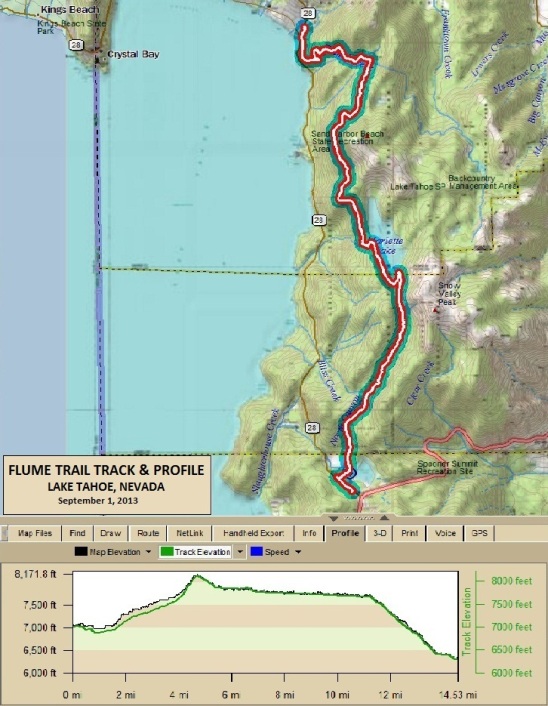
Mountain Biking - Special Trails - LAKE TAHOE, NV. Early in September of 2013, Bruce had some work to do near Reno, so he took advantage of the business trip to arrange a ride of the Flume and Tahoe Rim Trails in the Lake Tahoe area. A friend he used to ride with with in the Vegas and southern Utah areas, Debbie Wood, had recently moved to Reno and offered to be his riding partner for the Flume. The first day, he rented a Specialized Stumpjumper from Flume Trail bikes in Incline Village. He and Debbie took the shuttle out to Spooner Lake. From there, they rode the Flume back to the bike shop. The second day, he rented a Kona Hei Hei, and rode with Michael and Alex, a couple of riders he met at the shop. Alex and Michael were also riding the Tahoe Rim Trail and were on the shuttle out to Tahoe Meadows on NV-431. If Bruce were ever to do this again, he would start at the Tahoe Meadows location, ride the Tahoe Rim Trail south to Marlette Lake, and then ride the Flume back to the bike shop. This would make for a 24 mile (38.6 km) ride and about 5,000' (1,524 m) of climbing, but would be, in his opinion, the best way to do it. This version of the ride would take 4 to 6 hours to complete, depending on conditioning, so a full supply of sports drink and some food would need to be carried. Timber was required for the mines during the mining boom in the late 1800s of the nearby Comstock Lode in Virginia City. In 1873 Nevada State Controller Walter Hobart and former Nevada and California Surveyor General Seneca "Sam" Marlette were operating a small sawmill in what is now known as Incline Village. The timber around Lake Tahoe was placed on the incline railway where it was taken up 1,400 feet (430 m) up the 4,000 foot (1,219 m) long inclined railroad. After the lumber was brought up the Incline, it was dumped into a wooden V flume for the trip to Lakeview on the Virginia & Truckee Railroad. The metal plating reduced wear on the flume boards as the lumber was then dropped by a gravity flume down the eastern side of the mountains. While the Flume is not on the IMBA list of EPIC trails, it is one of most famous trails in America because of its spectacular views, and is on the list of "Must Ride Trails" for all mountain bikers. Below is the track and profile for the Flume ride.
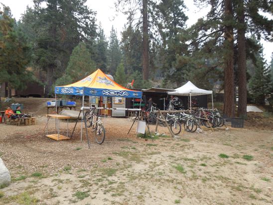
The ride from Spooner Lake is 14.3 miles long and has a cumulative elevation gain of 2,718'. The trail starts out at 7,000', rises to 8,177' in the first 4.7 miles, and ends at 6,322' above sea level. The ride started with a bike rental at Flume Trail Mountain Bikes in Incline Village. For the Flume, the rental bike was a Specialized Stumpjumper FSR Comp 29. The bike rental service operates out of an intermodal container converted to a shop.
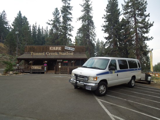
Flume Trail Mountain Bikes also operates a shuttle from the Tunnel Creek Station Cafe. The Shuttle goes to both the Spooner Lake and Tahoe Meadows trailheads on alternate runs.
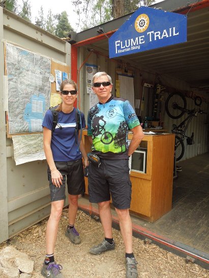
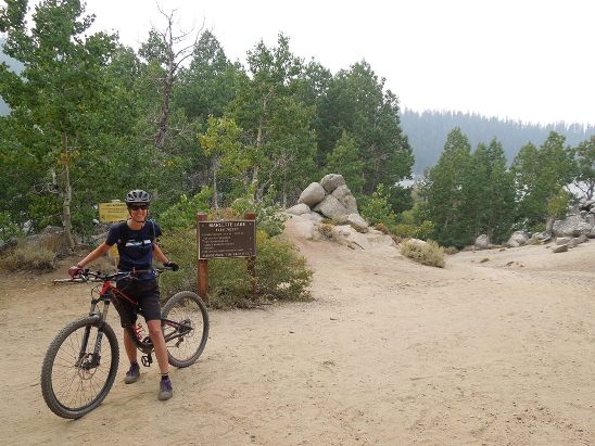
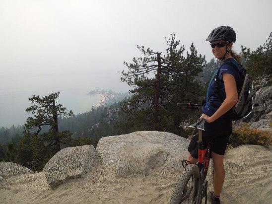
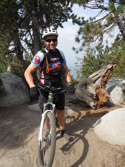
Below is a shot of Debbie and Bruce just before loading up on the shuttle to the Spooner Lake trailhead.
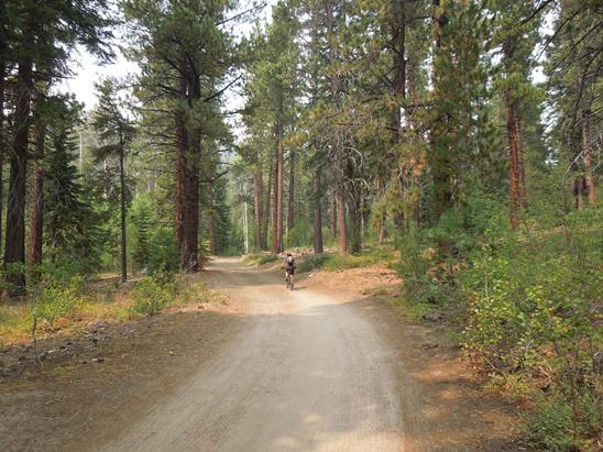
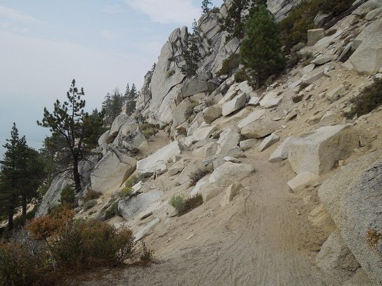
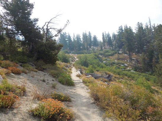
The initial climb was a killer. The photo above shows the climb in the distance. It was a 4.7 mile continuous uphill grind. The section below is typical of some of the "milder" parts of the climb. There were many sections were the grade was much steeper.
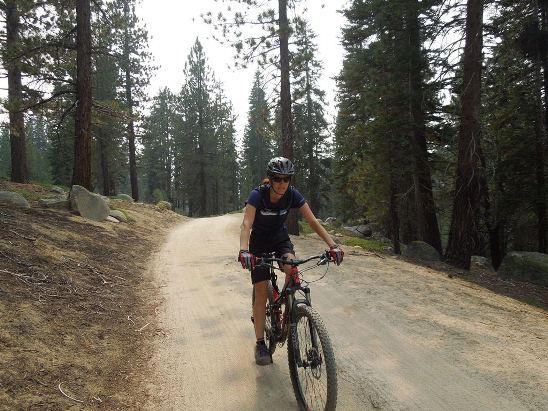
Overall, you climb from 7,000' to 8,124' in 4.7 miles. That is 1,124' of elevation gain. The average grade is 4.5%. Once at the top, it is mostly downhill.
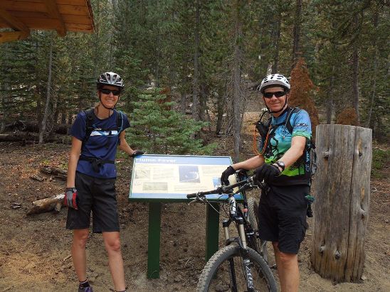
The initial climb is technically not the Flume Trail but the Marlette Trail. The Flume begins after the climb up the Forest Service road. Below is Debbie and Bruce at the plaque marking the beginning of the Flume.
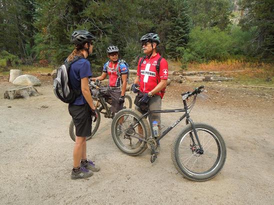
Along the way, Bruce and Debbie ran into the Tahoe Mountain Bike Patrol. Below is Debbie talking to Ray, one of the Patrol members about riding in the area. When asked about the Surly, Ray said it was perfect for the sandy trails in the Lake Tahoe area. The trail is not too sandy at this point, but further on it got to be several inches deep.
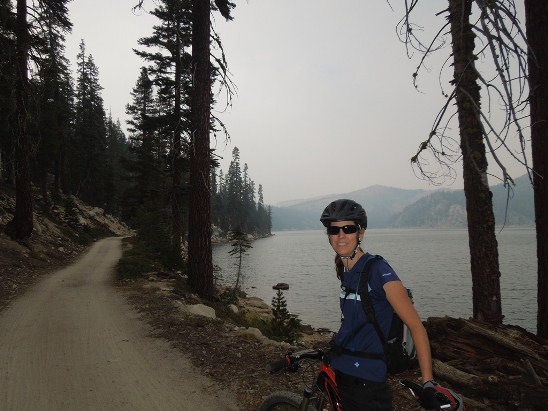
Just down the trail and around the bend, you come to Marlette Lake. The lake elevation is 7,823' above sea level.
The trail goes around the south end of the lake before continuing north. Below is Debbie on the trail by the southwest shore of the lake.
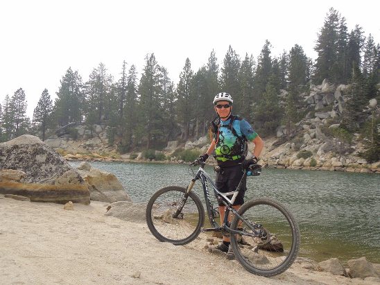
Below is a shot of Bruce at the south end of the lake. Notice the sand is getting deeper.
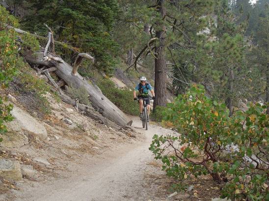
Bruce coming around a downed tree on the way up to Sand Point.
Debbie on the trail above Sand Point. Notice how much deeper the sand is getting.
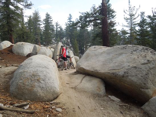
From the Sand Point over look, it was northward. In places, the trail got a bit technical trying to maneuver around the rocks in the soft sand.
Below is Bruce coming under the still living downed tree.
Then there is the shot of Debbie coming under the tree. This is one of the most photographed spots on the Flume.
Finally, a shot of Bruce on the trail with Sand Harbor below in the background.
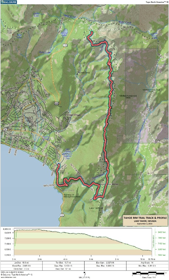
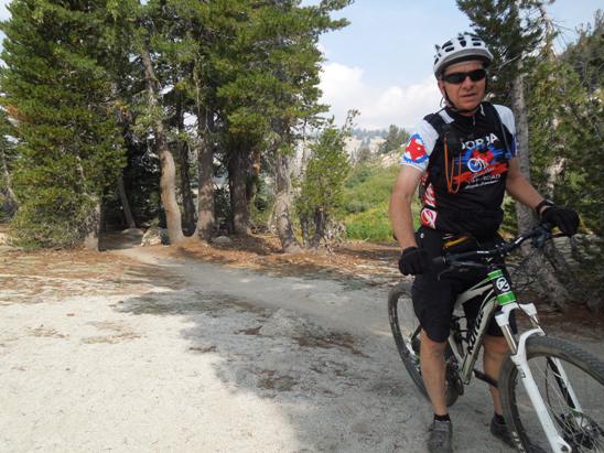
The Flume is one of those "Bucket List" trails for all serious mountain bikers, and he was very pleased to cross this one off, even if it was a bit smoky from the fire at Yosemite. The second day at Incline, Bruce rented a 2013 Kona Hei Hei 29er for the Tahoe Rim Trail (TRT) ride. He met Alex and Michael at the shop, and since Alex knew the trail and Michael and Bruce didn't, Alex offered to lead. The TRT is an IMBA EPIC Trail, so Bruce was happy to cross this one off his list. The TRT encompasses 165 miles along the ridge tops of the Lake Tahoe Basin, crossing six counties, and two states. It is an intermediate-level trail ranked No. 90 in the world. Bruce rode the section from Tahoe Meadows to Tunnel Creek Rd. The track and profile for the ride is shown below. For some reason, the GPS had trouble acquiring a usable signal at the start of the ride, so the track is about a half mile shorter than it should be. The starting point was off NV-431 near CR-340 at the top of the map.
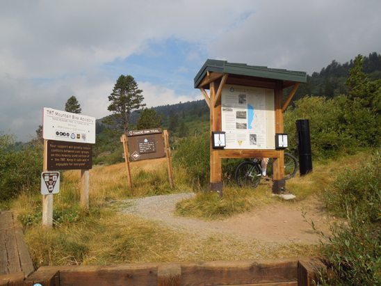
The ride from Tahoe Meadows was approximately 11 miles long and mostly down hill. The starting elevation was about 8,700', dropping to about 8,450' in the first half mile then climbing to 8,828' by mile two. From there it was mostly down hill to an ending elevation of 6,322'. The climbing elevation was 1,182' and that was in about one and a half miles at the beginning. The descending elevation was 3,509', and most of that came in the last third of the trail. The photo below shows the trail head at Tahoe Meadows.
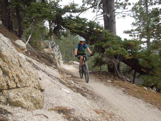
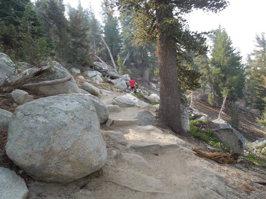
The TRT has a lot of sand and rocks. Below is a typical section on the climb up. The descending sections were very similar, but much easier to ride going down hill.
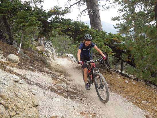
There were flat parts too. Like the Flume, the TRT also had a lot of sandy sections.
Below is Bruce catching his breath after the initial climb up from the meadow.
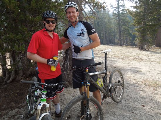
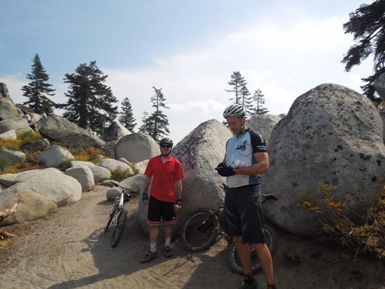
Below is Michael and Alex. Michael was also on a Kona rental bike.
There was lots of sand and rock on this trail, and a lot of the rocks were huge.
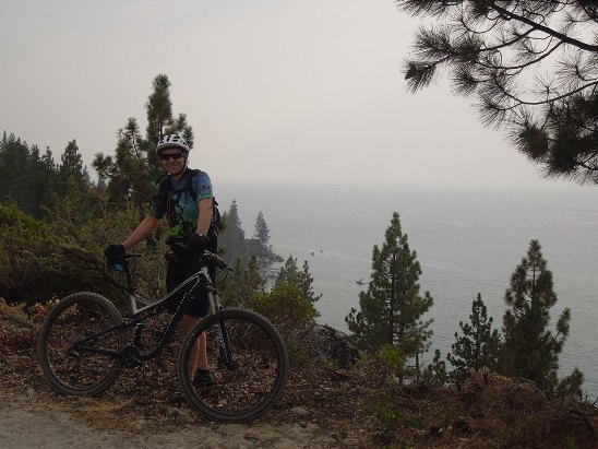
Below is a photo of Bruce at an overlook towards Reno. On a clear day, you could see Reno, but with the smoke, it wasn't possible that day.
Below is Michael and Alex at another rest stop.
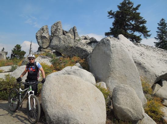
A little further down the trail, they stopped to get a photo of Bruce in a rock out-cropping.
This was a great ride. However, if he ever does it again, he plans to take the TRT to Marlette Lake and return via the Flume.
|
|
Version 1.0, September 28, 2013 |