|
Bruce
& Betsy Blais |
|
Mountain Biking - Special Trails - WHITE RANCH, COLORADO
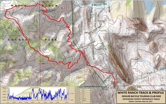
Below is a map showing the track, profile and statistics for the White Ranch ride. Right-click on the image below and use the "Save Target As" option to down-load a 1MB 11x17" PDF version of the map. You can also click on the image and zoom up to 200% for a detailed view in a separate window. Right click here to down load the GPX file. The file may want to save as an XML file, so change the extension to gpx before you save it. The file is a high-resolution track created on the Delorme PN-60W GPS.
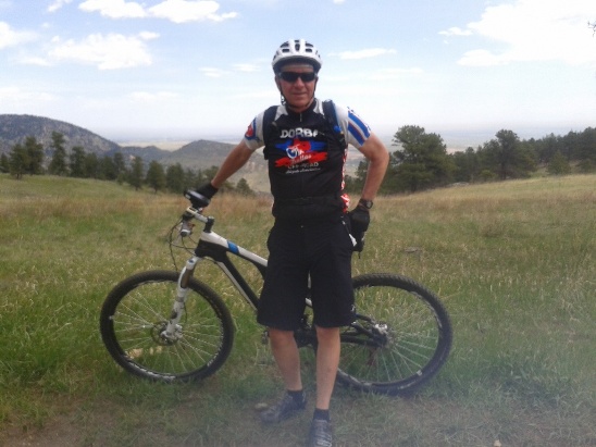
The distance ridden this day was 7.5 miles. The ride time was about 3 hr. 45 min. Climbing was 2,091 feet. Most of the climbing was in the first 3 miles. Below is a photo of Bruce on the Metcalf Trail about half-way up to the "Upper" parking lot.
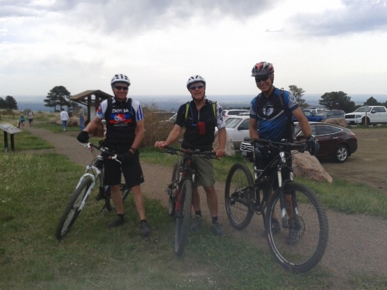
Part of the group at the upper lot. Bruce, Fred and Darrell.
Below is the long descent down from the parking lot. They got to jump lots of water diversion logs while screaming down the trail. Once at the bottom, it was "hike-a-bike" back out.
|
|
Version 0.1, May 18, 2014 |