|
Bruce
& Betsy Blais |
|
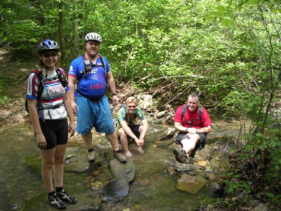
Mountain Biking - Special Trails - WOMBLE In May of 2009 and 2012, Bruce joined the members of the Dallas Off Road Bicycle Association (DORBA) for their annual trek to Camp Clearfork in the Ouachita National Forest. The forest is home to several famous trails, most notably the Womble IMBA EPIC trail. It is also home to the Ouachita Trail, famous for the Ouachita Challenge race each year. The trip in 2009 was a rain-out except for a ride Saturday morning. Below is s shot of a few folks taking a break at a creek crossing east of the parking lot on the Womble at Arkansas SR-298 .
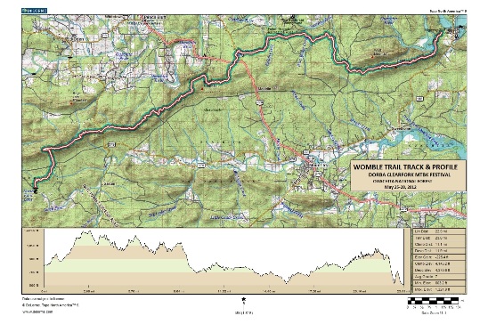
The 2012 trip was just great, although a bit warm. Below is a map showing the track, profile and statistics for the Womble ride. Right-click on the image below and use the "Save Target As " option to down-load a 1MB 11x17" PDF version of the map. You can also click on the image and zoom up to 200% for a detailed view in a separate window. Right click here to down load the GPX file. The file may want to save as an XML file, so change the extension to gpx before you save it. The file is a high-resolution track created on the Delorme PN-60W GPS.
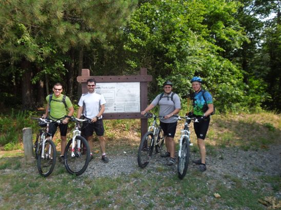
The distance ridden this day was 23.0 miles. The ride time was about 3 hr. 45 min. Climbing was 4,145 feet and descending was 4,371 feet. The photo below shows Bruce (far right) and his buddies Rob, Daniel and Bruce (L-R) at the North Fork Lake entrance to the Womble.
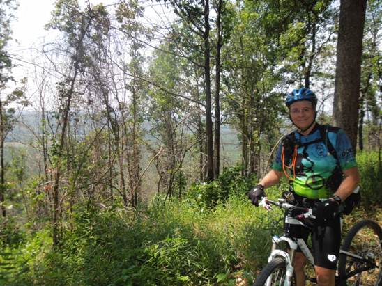
The first part of the ride is fairly technical with some climbs that are physically demanding. A quick check of the profile above bears this out. Below is a photo taken along one of the high sections near the start of the ride.
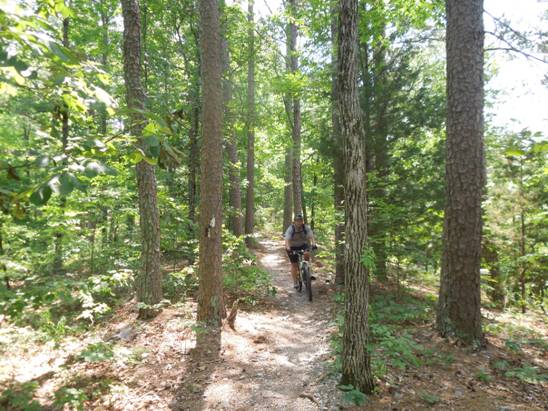
Below is a shot of the other Bruce coming down the trail near the beginning of the ride.
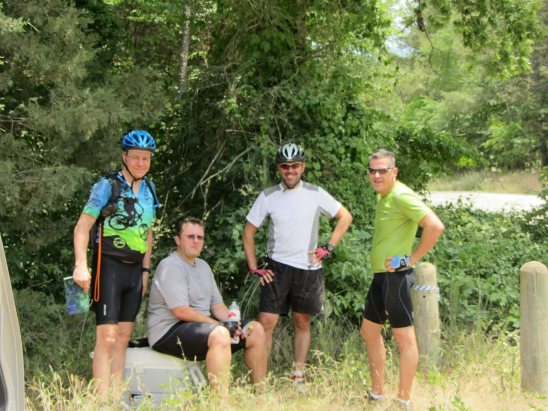
The mid point of the ride crossed Hwy 298. Other groups were riding from this location and we had them bring a cooler there for our mid-ride resupply stop. Left to right are Bruce, the other Bruce, Daniel and Rob.
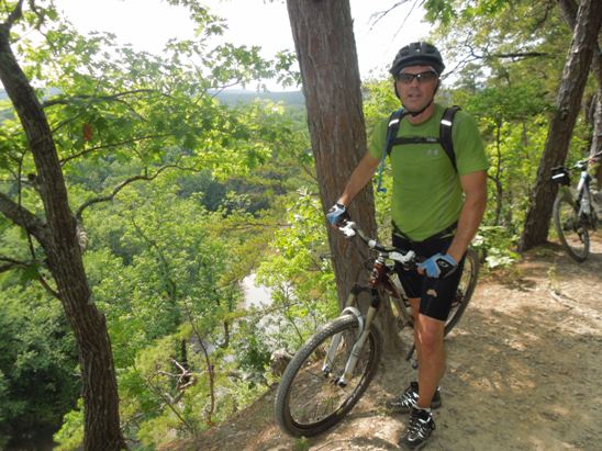
Towards the end of the ride, we came to the "bluff". Below is a shot of Rob where the trail comes up next to the edge of the Bluff.
From the Bluff, it is a steep descent and a lot of "in and outs" back to the parking lot.
|
|
Version 0.3, May 27, 2014 |